Emergency Beacons for Hiking: Types, How They Work and How Long Rescue Takes
What happens if you get into trouble in the mountains without mobile coverage? This guide explains the types of satellite distress beacons, how SOS works, realistic response times, costs, and which solution fits different hiking needs.
Send an SOS alert and location information even without mobile coverage—with the right device.
406 MHz Cospas–Sarsat and commercial satellite messaging.
An alert being received and rescuers arriving on site are two different time frames.
PLBs typically do not require a subscription; satellite messengers usually have service fees.
What is a distress beacon, and why does it matter when hiking?
Your SOS must reach rescuers even when the mobile network is unavailable.
Navigation and communication are different functions; a beacon provides a backup for communication.In the mountains, the question is not just whether you know where you are, but also how you will call for help when there is no mobile signal . A distress beacon is a device or supported feature that can transmit your location and request for help through a communication system independent of mobile networks.
“Emergency beacon” describes several technically distinct devices. A 406 MHz PLB is primarily designed to trigger an emergency alert, while a two-way satellite communicator can send and receive messages and may offer tracking. A GPS navigator alone does not necessarily have any way to call for help.
GPS/GNSS calculates your position. That does not automatically send your coordinates to anyone.
A successfully transmitted alert starts a response process; it does not guarantee that help will arrive within minutes.
If you can make a mobile call, dial 112 and follow the dispatcher’s instructions.

What types of emergency beacons are available?
PLBs, satellite messengers, simpler SOS units, phones and watches.
A practical guide to making the right decision outdoors.No single type is perfect for every hike. The key difference is whether you only want to send an emergency alert or also want to exchange messages in both directions with rescue coordinators or your contacts.
Transmits its identifier and usually its position over the dedicated 406 MHz distress frequency monitored by Cospas–Sarsat. It generally has no monthly subscription, but correct registration with the appropriate national authority and battery maintenance are important.
For example, Garmin inReach or ZOLEO. Besides SOS, these can provide text messaging, acknowledgements and, on some models, tracking and weather forecasts. An active service plan is usually required.
Some SPOT models, for example, send SOS alerts and preset check-in messages. Not all units support free-form, two-way text conversations.
Works only on supported models, with the appropriate software and in eligible countries or service areas. A smartwatch’s fall detection or mobile-network SOS calling does not automatically imply satellite connectivity.
An avalanche transceiver helps locate someone buried nearby. VHF/UHF radios provide radio communications where supported. Neither carries out the same global rescue coordination as a PLB or satellite SOS communicator.

How does a satellite distress alert work?
GNSS establishes your position; the emergency alert travels over a separate radio or satellite channel.
The photo shows a SPOT satellite messenger; the precise SOS process depends on the model and service plan.A device often combines two functions: its GNSS receiver determines your position, while the emergency transmitter sends the information. If the device cannot calculate reliable coordinates, some systems can estimate a location from the radio signal, but this can reduce accuracy or take more time.
Two different technical paths
- PLB, 406 MHz: the beacon transmits on a frequency monitored by Cospas–Sarsat. Satellites and ground stations relay the alert to the appropriate rescue coordination authority. Some devices also transmit a 121.5 MHz homing signal for nearby search teams.
- Satellite communicator: the alert reaches an SOS monitoring center through a commercial satellite network such as Iridium, which then contacts local rescue services.
- Acknowledgement: a two-way communicator can receive messages. The Galileo Return Link Service (RLS) on a compatible PLB can confirm receipt of an alert, but it is not a two-way chat with rescuers.
Seeing your position on a phone or GPS watch does not prove that it can send a distress signal by satellite without mobile coverage.

What else can they do beyond SOS?
Not every product offers the same features.
A practical guide to making the right decision outdoors.More capable satellite communicators can help you make safer decisions even before an emergency occurs . These are not standard PLB features, and service plans may limit access.
Let a preset contact know that you are safe and share your location.
Explain what happened, how many people are injured, and their condition; receive further instructions.
Your progress may be visible on a shared tracking page. This does not replace a coordinated rescue response.
Some services can provide forecasts for a selected waypoint. These are forecasts, not guaranteed on-site measurements, and not every SOS device offers them.
Some devices have maps and navigation features; neither is required to transmit an SOS.
A reply can reduce uncertainty, but it is not a guaranteed arrival time.
A location shared with family members does not necessarily reach rescue coordinators. If life or physical safety is at risk, you must initiate an explicit SOS alert or emergency phone call.

Who benefits, and on what kinds of hikes?
The decision depends on the potential consequences, not on whether your hike sounds “extreme.”
A practical guide to making the right decision outdoors.A beacon provides a particularly valuable safety backup when mobile coverage is unreliable , few other people are nearby, rescue access is difficult, or an unexpected injury prevents you from returning on your own.
After a fall, sprain or serious illness, there may be no one beside you to call for help.
Rough terrain, large elevation gains and fast-changing weather can make incidents more serious.
Check both network coverage and whether SOS activation is supported in your destination country.
Particularly useful where mobile coverage is patchy or a group becomes separated.
In busy, well-served areas with good reception, a satellite beacon may not be your first purchase. Offline maps, access to 112 and appropriate gear may matter more.
Carry the unit somewhere accessible, preferably on your body. A beacon inside a backpack that falls into a ravine or gets lost may be useless when an emergency occurs.

When is pressing the SOS button justified?
In a serious or potentially escalating emergency, following the device manufacturer’s guidance.
A practical guide to making the right decision outdoors.SOS is not meant as a shortcut for an uncomfortable hike, being late, or making a wrong turn. It may be justified if you are in immediate danger, have a serious injury, or cannot safely rescue yourself.
Loss of consciousness, major injury, a heart or breathing emergency, life-threatening hypothermia, or being trapped in a dangerous location.
Getting lost, exhaustion, or bad weather: consider the combined risks, injuries, available food and water, daylight, and whether you can safely return.
A convenience ride, an abandoned itinerary, or a non-urgent logistical problem.
- First: if mobile service is available, call 112 and share your coordinates, the number of injured people and their condition.
- If you cannot call: use your functioning, activated and compatible SOS device.
- Then: keep warm, make the scene safe, avoid moving an injured person unnecessarily, and remain reachable by rescue coordinators.
If you accidentally trigger SOS, report the false alert according to the device and monitoring center’s instructions. Do not simply ignore follow-up questions; depending on the service, callbacks or a rescue response may follow.
What happens after you send an SOS alert?
Once the alert is transmitted, several different organizations may become involved.
In wilderness rescue, information must reach the responders before help can be dispatched.The sequence below is a general model . The precise order differs between 406 MHz PLBs, satellite messengers, phone manufacturers and rescue authorities in the destination country.
- SOS activation: the device records its identifier, coordinates if available, and the time of the alert.
- Transmission: a satellite and ground station, or a commercial satellite provider, receives the alert. Deep valleys can delay this.
- Receipt and assessment: a rescue coordination authority or 24/7 monitoring provider evaluates the information. With two-way messaging, it may ask questions.
- Notifying local responders: the relevant authority or rescue organization arranges available ground and air resources.
- Accessing the scene: rescuers travel by road, on foot or by air. Distance, weather and access determine arrival time.
- Treatment and closure: medical care, possible evacuation and documentation are separate parts of the operation.
A “we received your SOS” message on a two-way device, or a Galileo RLS acknowledgement on a PLB, means that the alert system is aware of the incident. It does not mean rescuers have arrived or that a helicopter has been dispatched.

How long does it take to respond to an SOS alert?
Receiving the signal, coordinating a response and rescuers arriving are three separate stages.
A practical guide to making the right decision outdoors.There is no universal promise that help will arrive within 5, 10 or 30 minutes of an SOS. The same device may work quickly on open ground but more slowly in a sheltered valley. Rescue teams also face additional operational constraints.
Under favorable conditions, the Cospas–Sarsat Galileo/MEOSAR system can detect 406 MHz distress beacons in near real time. Official European materials refer to detection and location typically within 10 minutes. This is not the arrival time of rescuers , and it is not a guarantee for every transmission.
A two-way SOS center may send a message and ask for more information. Verifying the incident, alerting the responsible rescue service and assigning resources takes additional time. There is no universal response-time figure.
Help may arrive sooner when roads are accessible and units are nearby. Rocky, stormy, snowy, forested or remote terrain can mean several hours, or considerably longer in difficult conditions. Helicopters cannot always take off or land.
| Time or event | What it means | What it does NOT mean |
|---|---|---|
| SOS sent | The device has started transmitting the distress alert. | The system has not necessarily received it yet. |
| SOS received / RLS response | A supported device has received confirmation of the alert. | It does not prove that an ambulance or helicopter is on its way. |
| Rescue unit alerted | The local authority has begun organizing a response. | No arrival time can be guaranteed from this alone. |
| Rescuers on scene | Treatment and, if needed, evacuation can begin. | The total duration of the rescue operation may still be unknown. |
The European Union’s Galileo SAR materials describe fast detection and positioning, while NOAA’s official PLB FAQ explains that each rescue is unique. A manufacturer’s 24-hour SOS coordination service is not a guaranteed on-site rescue response time.

What should you tell the rescue coordinator if you can reply?
Concise, accurate information helps responders send the right resources.
A practical guide to making the right decision outdoors.With a two-way satellite communicator, an SOS center will often try to contact you by message. Prioritize your coordinates, injuries and immediate hazards . Without two-way communication, your registration details and the hiking plan shared with your contacts may become especially important.
- Where are you? GNSS coordinates, the last confirmed landmark, trail marking and estimated elevation.
- What happened? A fall, injury, illness, getting lost, hypothermia or being trapped — briefly.
- How many people are with you? Number of casualties, consciousness, breathing and ability to move.
- What other dangers are present? Cliff edge, avalanche risk, flooding, lightning or approaching darkness.
- Can rescuers reach you? Road or trail access, possible safe meeting point.
- What resources do you have? Warm clothing, shelter, water, medicines, mobile coverage or companions at the scene.
“Two people. One has an ankle injury and cannot bear weight; both conscious. Coordinates sent by device. Rocky trail, strong wind, no mobile coverage. Emergency bivvy available; staying in place.”

What can prevent an emergency beacon from working?
Satellite links still depend on the terrain and condition of the device.
A practical guide to making the right decision outdoors.Saying a product “works worldwide” is not enough. Network coverage, national regulations, subscription status, visibility of the sky and correct device use all affect what you can expect.
Mountainsides can block large parts of the sky, slowing access to satellites.
These can reduce radio reception. Position the device as instructed by its manufacturer.
Operating time and cold temperatures matter for rechargeable communicators; PLBs have a specified battery replacement deadline.
SOS on commercial satellite messengers usually requires an active service plan.
Phone-based satellite SOS and some other services have geographic restrictions.
Correct orientation and a clear view of the sky may be essential, according to the device’s instructions.
If you can do so safely, improve the device’s view of the sky. Never move to a cliff edge, lightning-exposed ridge or unstable slope just to reach a satellite.
How much does an emergency beacon cost?
Consider the device price, service plan, registration and rescue coverage.
A practical guide to making the right decision outdoors.Prices and subscriptions change frequently, so we do not present fixed prices as current offers . The cost differences between device categories are nevertheless easy to understand.
| Device type | Upfront cost | Ongoing costs and considerations |
|---|---|---|
| 406 MHz PLB | Normally purchased as a standalone device | Generally no monthly SOS plan; registration, periodic battery replacement and possible servicing still matter. |
| Two-way satellite communicator | Device purchase or a special service arrangement | Usually activation, subscription, messaging/data allowances and possibly a suspension fee. |
| Basic satellite messenger | Device purchase | Service plan, activation or annual fee is common. |
| Satellite SOS-capable phone | Compatible smartphone | Availability and charges vary by country, device and time period. |
Sending satellite SOS messages and receiving rescue coordination generally does not automatically mean that helicopter rescue, medical treatment or evacuation costs are covered. Check your insurance policy’s geographical and activity exclusions.
PLB, Garmin inReach, ZOLEO, SPOT, or phone?
What each system is best suited for — examples, not a brand endorsement.
A practical guide to making the right decision outdoors.This table compares product families. Not every model supports every feature listed ; up-to-date manufacturer documentation and availability in your destination country are decisive.
| Solution | SOS channel | Two-way messaging | Typical ongoing costs |
|---|---|---|---|
| PLB — e.g., ACR ResQLink, Ocean Signal rescueME | 406 MHz / Cospas–Sarsat | Usually no free-form chat; RLS confirmation on some models | Normally no monthly SOS subscription |
| Garmin inReach family | Satellite messaging and 24/7 coordination | Yes, on many models | An active service plan is generally required |
| ZOLEO | Satellite SOS and 24/7 coordination | Yes, usually through a phone app; the SOS button also works independently | An active subscription is required |
| SPOT products | Satellite SOS | Model dependent: one-way and two-way options exist | A service plan may be required |
| Supported smartphone | Satellite SOS depends on manufacturer and region | Limited service-specific two-way interaction may be available | Varies by country, device model and terms |
Consider a 406 MHz PLB. Registration and battery life are not optional details.
A two-way inReach- or ZOLEO-type communicator may be the better choice.
Verify the exact model, destination country and whether satellite SOS can actually be activated there.
As of October 2026, Apple’s official supported-country list does not include Hungary for Emergency SOS via satellite. Availability may differ in a neighboring country, so check the current list before departure.
How to prepare your emergency beacon before a hike
Even a great device will not help if it does not work, is not activated or cannot be reached.
A practical guide to making the right decision outdoors.Five minutes of preparation before you leave can be worth far more than a more expensive device you do not know how to use.
- Registration: For a PLB, make sure the official registry appropriate to the beacon’s country code has your correct owner and emergency-contact information. Do not assume that registration in Hungary is identical to the US NOAA process.
- Active service: for a communicator, check that your plan and SOS feature are active in your destination country.
- Battery: charge rechargeable units; check battery replacement and expiry dates and the specified service life of a PLB.
- Testing: use only the manufacturer’s permitted self-test procedure. Never trigger a real SOS as a test unless you follow an officially authorized test procedure.
- Accessibility: carry the device on your body or somewhere immediately accessible, not buried inside your backpack.
- Trip plan: tell a trusted person your route, expected return time and what to do if you miss a planned check-in.
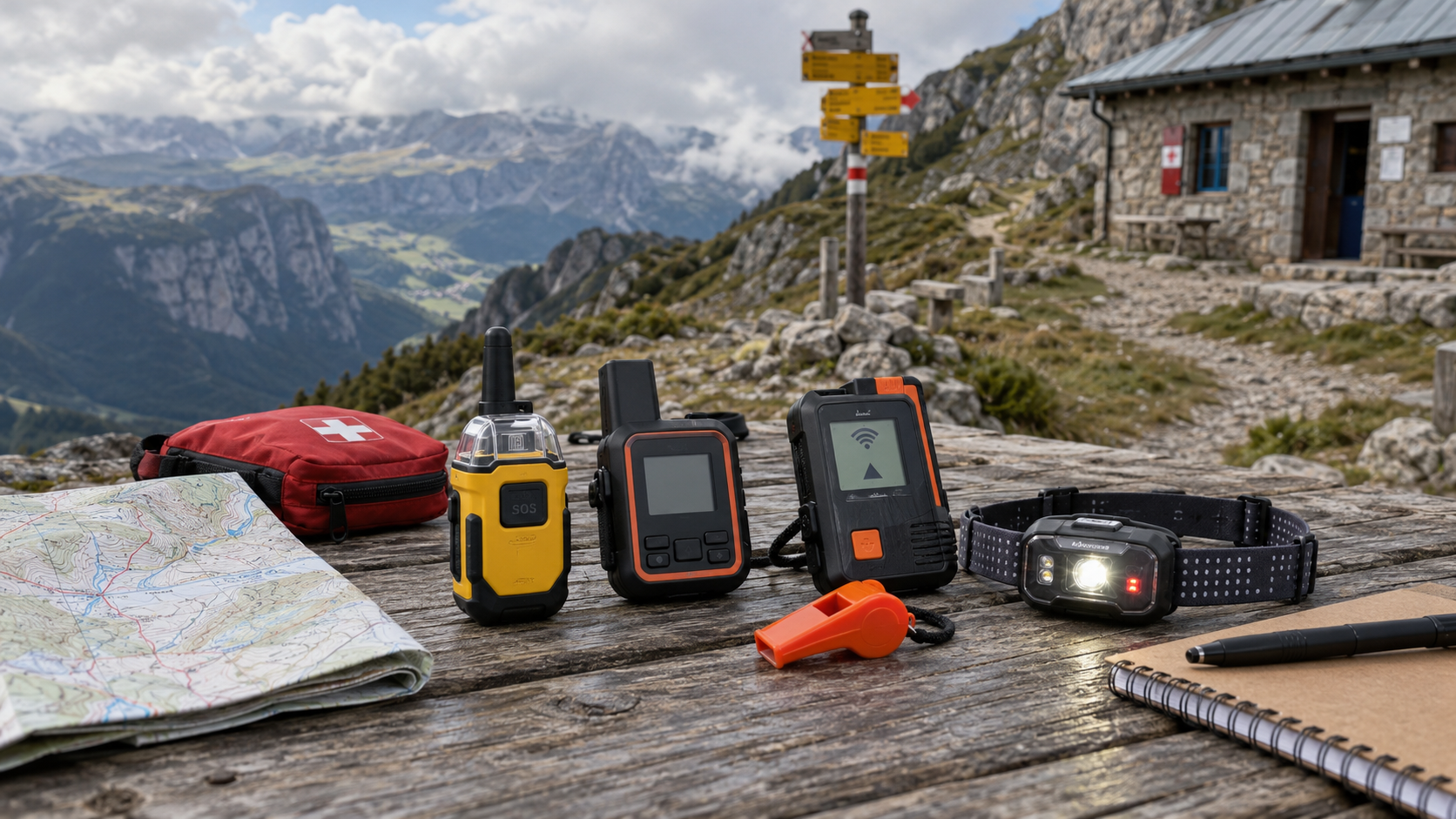
- Field safety: bring offline maps, basic first aid, warm layers, a headlamp, backup power and enough water.
A known itinerary and check-in time can help your contact person and rescue coordinators, particularly if the beacon transmits incomplete location information.

Frequently asked questions about satellite emergency beacons
Short answers to the most important misconceptions.
A practical guide to making the right decision outdoors.If I press SOS, how soon will a helicopter arrive?
There is no universal answer in minutes. A signal may be received within minutes, but mobilizing local rescue units, the weather and difficult terrain can mean an arrival time of hours or longer. Helicopters are not always an option.
Does a PLB require a subscription?
Traditional 406 MHz PLBs generally do not need a monthly SOS subscription. However, required registration, the correct country code and periodic battery replacement remain important.
Is my GPS watch an emergency beacon?
Not automatically. Many watches can only call for help or share incident-detection alerts via a mobile connection. Satellite SOS capabilities must be checked for the specific model.
Do I always need a smartphone for satellite SOS?
No. A PLB works independently. Several standalone communicators can trigger SOS with their own button; some need a smartphone app for message exchanges.
What if I activate SOS by accident?
Tell the monitoring center as soon as possible, following the manufacturer’s and provider’s instructions for a false alarm. Stay in contact with the operator if possible to avoid confusion.
Does Galileo RLS mean help is coming?
RLS confirmation indicates that the distress alert has been received and the location determined; it does not tell you when rescuers will arrive.
If I have no mobile signal, will 112 also fail?
In some cases, a 112 emergency call may use another available mobile network even when your own provider has no service. With no radio coverage at all, this is not guaranteed; that is why a genuine satellite backup can be valuable.
Does satellite SOS on iPhone work in Hungary?
Hungary is not included in Apple’s official supported-country list as of October 2026. Before departure, check the latest list and conditions for your phone model and destination country.
How much might a rescue cost?
It varies with the country, circumstances, rescue organization and insurance rules. An SOS subscription is not automatically rescue or evacuation insurance.
What is the difference between SOS and tracking?
SOS is an explicit emergency request for assistance. Tracking is periodic or occasional location sharing, which does not itself mean an official rescue has been launched.
Emergency beacons matter because they can send a request for help when normal communication routes are unavailable . When choosing one, network coverage, communication options, supported countries and battery life matter more than marketing promises.
A distress beacon cannot shorten the mountain, but it can alert rescuers when you are in trouble
Consider a 406 MHz PLB
With correct registration, maintenance and country coding, it provides independent emergency alerting; it is not a general-purpose communicator.
Choose a two-way satellite communicator
Messages, SOS and sometimes tracking and weather can make a major difference when coordinators know what happened. Check the service plan, too.
Receiving an alert does not mean rescuers have arrived
After sending SOS, prepare to keep yourself and your companions safe while you wait. Remain accessible and follow the rescue coordinator’s instructions.

Sources, photos and usage rights
Sources checked: October 2026. Technical specifications, supported countries, devices and service terms may change. This guide is not sponsored and does not replace the manufacturer’s instructions or directions from rescue coordinators.
- Cospas–Sarsat: official explanation of the 406 MHz beacon system
- U.S. Coast Guard: how SARSAT alerts work
- NOAA: 406 MHz beacon registration and rescue response time FAQ
- EUSPA: Galileo Search and Rescue and Return Link Service
- EU Space: examples of detection and positioning within 10 minutes
- Garmin: inReach and Garmin Response SOS coordination
- ZOLEO: what happens after an SOS is sent?
- ACR: subscription-free PLBs and comparison of RLS functions
- Apple: satellite SOS — supported countries and devices
- Hungarian Police: 112 emergency number
Photo credits and usage rights: Wikimedia Commons images are credited with their creators and licenses directly in the captions; the linked Commons file pages contain the exact reuse requirements. The images are displayed in 16:9 using CSS cropping; the original files are not altered.
- Mdarcangelo / Wikimedia Commons — CC BY-SA 4.0
- NASA Goddard / Rebecca Roth — public domain
- Tony Webster / Wikimedia Commons — CC BY-SA 3.0
- The Marmot / Wikimedia Commons — CC BY 2.0
- Salamanamanjaro / Wikimedia Commons — CC BY-SA 4.0
- Yellowstone National Park / NPS — public domain
- Ibex73 / Wikimedia Commons — CC BY 4.0
- Yellowstone National Park / NPS — public domain
- Sanjay Acharya / Wikimedia Commons — CC BY-SA 4.0
- Stefan Reitzner / Wikimedia Commons — CC BY-SA 2.0 DE
Rescue response time: Detecting an SOS within minutes does not mean rescuers will arrive within minutes. NOAA states that no single general rescue arrival time can be given. Using a beacon does not automatically include rescue or evacuation insurance.