
Hungarian El Camino: St James Way in Hungary
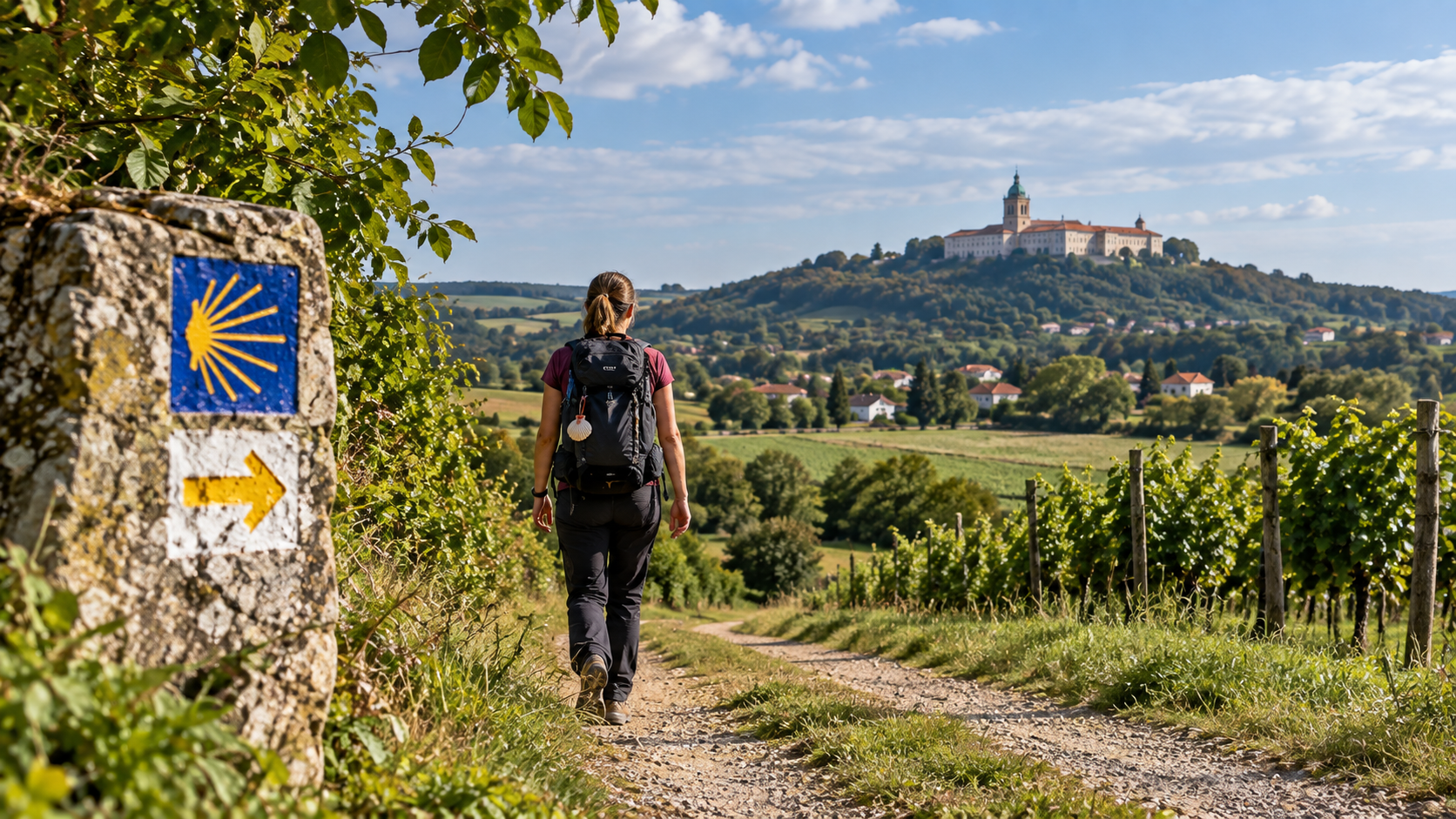
You do not have to travel to Spain to set out on a multi-day pilgrimage following St James Way markers. In Hungary, there are two official St James routes to choose from: the Camino Húngaro starting in Budapest and the Camino Benedictus starting in Tihany meet at Lébény, after which the shared route continues towards Rajka, Bratislava and Wolfsthal. At Wolfsthal, the Hungarian route joins the wider European Camino de Santiago network. One distinction is important, however: the commonly used term “Hungarian El Camino” is not the same as the Hungarian Pilgrims’ Way running between Esztergom and Máriagyűd.
Camino Húngaro starts in Budapest, while Camino Benedictus starts in Tihany. Both head towards Lébény.
The full official route to Wolfsthal is 282 km from Budapest and 243 km from Tihany.
The main waymark of the Hungarian St James Way is the yellow scallop shell; the base of the shell indicates the direction of travel.
It can be used to collect stamps, access discounted pilgrim accommodation and obtain the Lébény certificate.
- Start from Budapest or TihanyThe two Hungarian St James branches join in the Pannonhalma area, then continue towards Lébény.
- Lébény is the main pilgrimage destination in HungaryThe more than 800-year-old Church of St James is one of the most important landmarks on the Hungarian Camino.
- The route does not end at WolfsthalFrom here, the pilgrimage can continue through the European Camino network all the way to Santiago de Compostela.
- It is not a speed challengeDaily stages of 20–30 kilometres are demanding, but the rhythm of a pilgrimage is not about speed.
“Hungarian El Camino” usually refers to the Hungarian sections of the St James Way
The same pilgrimage tradition, through Hungarian landscapes
The Hungarian St James Way is not a replica: it physically connects to the European Camino network leading towards Santiago de Compostela.
The Hungarian St James Way belongs to the same pilgrimage tradition as the Spanish Camino de Santiago. Pilgrims can start from Budapest or Tihany, reach the Hungarian St James shrine at Lébény, then continue beyond Rajka through Slovakia into Austria. At Wolfsthal, the route joins the westbound Camino network, making it possible in principle to walk all the way from Hungary to Santiago.
“Hungarian El Camino”, “Hungarian Camino” and “Hungarian St James Way” are often used for the same route system. A separate route is the Hungarian Pilgrims’ Way, which runs from Esztergom to Máriagyűd.
Camino Húngaro or Camino Benedictus: the same destination, very different opening days
Budapest–Gerecse or Tihany–Bakony?
The two routes differ most in character on the sections leading to Pannonhalma.| Route | Total distance to Wolfsthal | Official stages | Main character |
|---|---|---|---|
| Camino Húngaro | 282 km | 11 stages | Budapest – Zsámbék Basin – Gerecse – Tata – Pannonhalma – Győr – Lébény |
| Camino Benedictus | 243 km | 10 stages | Tihany – Balaton Uplands – Bakony – Bakonybél – Pannonhalma – Győr – Lébény |
As far as Lébény, Camino Húngaro is roughly 200 kilometres, while Camino Benedictus is about 170 kilometres. From Lébény onward, the routes share the same direction: Mosonmagyaróvár, Rajka, Bratislava and Wolfsthal.
From Budapest via Zsámbék, Tata and Pannonhalma to Lébény
Official daily stages and optional route variants
The distances below follow the current route data of the Hungarian St James Way association. Some stages also offer A/B or Peregrinus alternatives.| Stage | Distance | Estimated walking time |
|---|---|---|
| Budapest – Zsámbék | 31 km | approx. 8 hours |
| Zsámbék – Tarján | 23,5 km | approx. 6 hours |
| Tarján – Tata | 20–25 km | approx. 6–6.5 hours |
| Tata – Nagyigmánd | 22,3–23 km | approx. 6 hours |
| Nagyigmánd – Kisbér | 21 km | approx. 5.5 hours |
| Kisbér – Pannonhalma | 28 km | approx. 8.5 hours |
| Pannonhalma – Győr | 24–26,4 km | approx. 8 hours |
| Győr – Lébény | 25 km | approx. 6.5 hours |
| Lébény – Mosonmagyaróvár | 26 km | approx. 7.5 hours |
| Mosonmagyaróvár – Rajka | 18 km | approx. 5 hours |
| Rajka – Wolfsthal | 30–35 km | approx. 7.5–11 hours |
One distinctive feature of the Budapest branch is that the very first day is already a 31-kilometre stage. If you have never done a multi-day pilgrimage before, it is worth testing the load of the first few days in advance and, where accommodation allows, creating your own stage breakdown if necessary.
From Tihany through the Bakony: the Hungarian Camino linking Benedictine monasteries
Tihany, Bakonybél and Pannonhalma form the backbone of the route
Camino Benedictus is shorter than the Budapest branch, but the Bakony terrain means it is not automatically easier in terms of terrain or daily effort.
| Stage | Distance | Estimated walking time |
|---|---|---|
| Tihany – Nagyvázsony | 23,1–23,7 km | approx. 8 hours |
| Nagyvázsony – Városlőd | 23 km | approx. 7 hours |
| Városlőd – Bakonybél | 18 km | approx. 6 hours |
| Bakonybél – Bakonyszentlászló | 21,5 km | approx. 7 hours |
| Bakonyszentlászló – Pannonhalma | 25,2 km | approx. 7.5 hours |
| Pannonhalma – Győr | 24–26,4 km | approx. 8 hours |
| Győr – Lébény | 25 km | approx. 6.5 hours |
| Lébény – Mosonmagyaróvár | 26 km | approx. 7.5 hours |
| Mosonmagyaróvár – Rajka | 18 km | approx. 5 hours |
| Rajka – Wolfsthal | 30–35 km | approx. 7.5–11 hours |
One of the strengths of the Tihany branch is the variety of landscapes it connects: the more open terrain of the Tihany Peninsula is followed by the forested sections of the Bakony, then by the flatter Little Hungarian Plain after Pannonhalma.
The shell shows the way, but GPX tracks and the pilgrim credential are also important companions
How navigation and proof of pilgrimage work on the Hungarian Camino
The waymarks are easy to recognise, but in forests, settlements and on alternative branches it is worth keeping the official GPX track at hand as well.| Pilgrim credential | What does it provide? |
|---|---|
| Not compulsory, but recommended | It can be used for a single pilgrimage on both the Hungarian and Iberian Camino routes. |
| Collecting stamps | Stamps confirming your journey can be collected at accommodation, churches and settlements. |
| Discounts | Some recommended accommodation offers pilgrim rates, and some places also provide pilgrim menus. |
| Lébény certificate | According to the official information, it can be requested with the required stamps collected from at least Pannonhalma onward. |
| Current price | HUF 1,500 in September 2026. |
The shell markers alone are not a substitute for an offline map. Download the official GPX before departure and keep a map on your phone that can display the route without mobile coverage.
The Hungarian Camino does not have Spanish-style infrastructure: more needs to be arranged in advance
Some pilgrim accommodation is not continuously staffed
The official organisation specifically asks pilgrims to contact accommodation in advance.
Official accommodation lists are available on the route stage pages. Because the route typically involves 20–30 kilometres per day, it is not advisable to rely solely on finding accommodation spontaneously on the same day, especially in high season and in smaller settlements.
The biggest challenge of the Hungarian Camino is not altitude, but the many long days in succession
Your feet, backpack and daily rhythm matter more than pace
A 25-kilometre day is manageable for many people on its own. The real strain comes from having to set out again the next day.| Factor | Practical recommendation |
|---|---|
| Season | Spring and autumn are generally more comfortable. In summer, exposed sections, asphalt and the heat of the Little Hungarian Plain can be demanding. |
| Footwear | Well-broken-in hiking shoes or lighter boots. Do not start wearing new footwear on the first day of the pilgrimage. |
| Backpack | Carry only what you genuinely need. Unnecessary kilograms multiply the strain over hundreds of kilometres. |
| Rain protection | A lightweight rain jacket and waterproof packing for your backpack contents matter more than carrying a heavy spare wardrobe. |
| Water | Adjust your water supply to the day’s route. In hot weather, longer stretches without settlements require more fluids. |
| Phone | Keep an offline map, the official GPX, accommodation contacts and a power bank at hand. |
| Training | Before departure, try walking 15–25 km on at least a few consecutive days with the backpack you plan to carry. |
- Test your shoes and socks firstBlisters, chafing and recurring pressure points are among the most common problems on a long-distance walk.
- Try two long days back to backThis tells you much more about your real endurance than a single 30-kilometre effort.
- Do not plan every day at your maximumAn average of 20–25 kilometres is more sustainable for many people than repeatedly walking 30+ kilometres.
- Leave a spare dayWeather, blisters, fatigue or a stage that takes longer than expected can make an easier or rest day very useful.
Two separate systems, two different waymarks and two different routes
The most common misunderstanding, in one table
Both are inspired by the Camino pilgrimage tradition, but they are not the same route.| St James Way / “Hungarian El Camino” | Hungarian Pilgrims’ Way | |
|---|---|---|
| Main direction | Budapest or Tihany → Lébény → Rajka → Wolfsthal | Esztergom → Budapest → Dabas → Kalocsa → Szekszárd → Pécs → Máriagyűd |
| International connection | At Wolfsthal it joins the Camino network leading towards Santiago | Independent Hungarian pilgrimage-route system |
| Main waymark | Yellow scallop shell | Yellow double cross ending in an arrow |
| Full main route | Camino Húngaro 282 km, Camino Benedictus 243 km to Wolfsthal | Esztergom–Máriagyűd approx. 431 km |
If you specifically want a Hungarian route connected to the Camino de Santiago tradition and network, the St James Way is the relevant system. If you want a longer pilgrimage crossing Hungary from north to south, the Hungarian Pilgrims’ Way may be more suitable.
“It is just a longer Hungarian hike; I will sort things out as I go.”
Daily distances of 20–30 kilometres, cumulative strain, advance accommodation arrangements and water planning mean that the Hungarian Camino requires more preparation than a day hike.
Route → available time → daily distance → accommodation → GPX → gear → test days.
Once you have this planned, only one thing remains: set out and let the rhythm of the pilgrimage shape your days.
Sources and background
Route lengths, stage data, waymarks, pilgrim credential information and accommodation details are based on the official Hungarian St James Way information available in September 2026. Prices, accommodation and services may change, so always check current information before departure.
- St James Way – official website
- Camino Húngaro – Budapest–Lébény–Wolfsthal route and stages
- Camino Benedictus – Tihany–Lébény–Wolfsthal route and stages
- St James Way – waymarks
- St James Way – pilgrim credential
- St James Way – credential and current fee
- St James Way – pilgrim accommodation and accommodation lists
- St James Way – general information
- Hungarian Pilgrims’ Way – official route guide
- Hungarian Pilgrims’ Way – stages and maps
- Wikimedia Commons – Tihany Abbey, Mocsarbalazs, CC BY-SA 4.0
- Wikimedia Commons – Tata Castle from Lake Öreg, EtelkaCsilla, CC BY-SA 3.0
- Wikimedia Commons – Pannonhalma Archabbey, Pasztilla, CC BY-SA 4.0
- Wikimedia Commons – Church of St James in Lébény, Pasztilla