
Weather Apps for Hiking — Which Ones Should You Use?
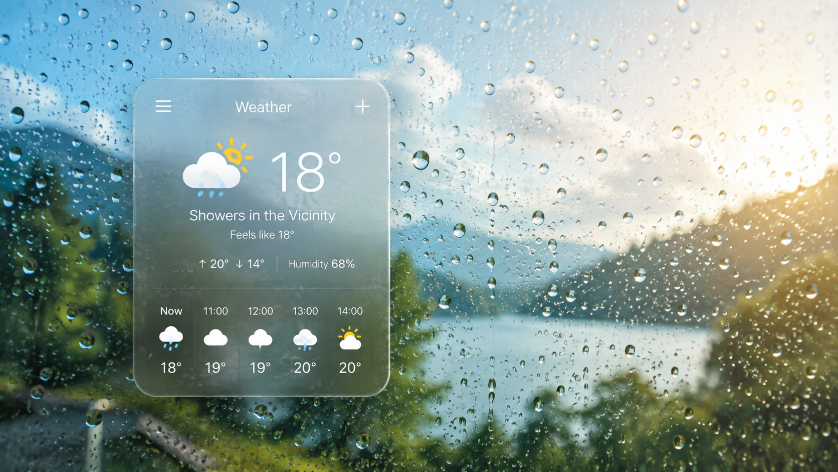
You do not need to be a meteorologist to make a useful decision from a weather app. For most hikes, a few data points are enough: wind gusts, the timing and amount of precipitation, temperature at your hiking elevation, cloud cover or visibility, plus radar and official warnings before you set off.
- Check your hiking elevationTemperature, wind and cloud can be very different in the valley and on the summit.
- Check the gustsAn average wind of 20 km/h can still come with gusts of 40–50 km/h.
- For rain, check the millimetres and the hour0.5 mm over three hours is very different from 6 mm in a single hour.
- Cloud, visibility, thunderstormOn a ridge, these often matter more than the daily weather icon.
- Check radar before setting offLook at where the precipitation is and which way it has been moving in the latest radar frames.
Six data points tell you far more than the daily icon
Look for these in the hourly forecast
You do not need to learn every meteorological layer.| Data | What does it mean? | Example |
|---|---|---|
| Wind gusts | The strongest wind that occurs for short periods. | 20 km/h average + 45 km/h gusts: at times the wind can be more than twice as strong as the average. |
| Precipitation in mm | The expected amount of water. 1 mm ≈ 1 litre/m². | 5 mm in one hour is a very different situation from 5 mm spread over the whole day. |
| Timing of precipitation | The hours when rain or snow is expected. | If precipitation is expected between 14:00 and 16:00, a morning hike and an afternoon hike are not the same plan. |
| Temperature | Check it at the elevation of your route or summit whenever possible. | A valley forecast of 18 °C does not mean it will also be 18 °C at 1,500 metres. |
| Cloud cover / visibility | Shows whether the mountain may be in cloud and how far you may be able to see across the terrain. | If the cloud base is at 1,200 m and your destination is at 1,600 m, there is a good chance you will be hiking in cloud. |
| Official warning | A hazard warning issued by the national meteorological service. | Check this separately when thunderstorms, strong wind, freezing rain or significant precipitation are possible. |
The percentage does not tell you how much rain is expected. The same 60% may refer to a brief shower of only a few tenths of a millimetre or to several millimetres of rain. Always check the amount and hourly timing.
Always check the location and elevation of the actual hike
A forecast for the nearby town may not describe what is happening on the ridge or summit.
A weather app becomes much more useful when you stop looking at the general daily icon and instead check hourly data close to the route and at roughly the elevation where you will actually be hiking.
You do not need eight apps — choose the one that answers the question you actually have
Useful choices for hiking
Planning, mountain forecasts and the final check before departure are different jobs.| Tool | What is it useful for? | When is it useful? |
|---|---|---|
| Windy.com | Wind, gusts, precipitation, cloud cover, radar and several forecast options on a map. | One of the best starting points for general hike planning. |
| meteoblue | Detailed hourly data and comparison of multiple forecasts. | Useful when you want to see how consistent or uncertain the forecast is for the next few days. |
| bergfex | Mountain and valley weather, snow, webcams and Alpine locations. | Especially practical for hiking in Austria, Slovenia and the Alps. |
| Mountain-Forecast | Specific mountain summits and multiple elevation levels. | Useful when you care about the summit itself rather than the nearby town. |
| Yr | Clear hourly temperature, precipitation and wind. | Good for a quick check and especially useful in Norway. |
| RainViewer | Precipitation radar and movement of rain or snow areas. | Before setting off and for the short term. |
| Ventusky | A clear visual weather map with many layers. | A strong alternative if you do not get on with the Windy interface. |
| HungaroMet | Official Hungarian forecast, radar, warnings and observations. | Worth knowing for any hike in Hungary. |
The Windy.com and Windy.app are two different services. This article refers to Windy.com.
If you do not want to jump between lots of apps
Three simple use cases: general planning, official Hungarian warnings and Alpine or mountain forecasts.Windy.com + RainViewer
The Windy.com should be your general planning tool: hourly wind, gusts, precipitation, temperature and cloud cover in one place. RainViewer is useful before departure for quickly seeing where rain is actually falling and which way it is moving. RainViewer is available for iPhone and Android.
HungaroMet Meteora
The Meteora is HungaroMet’s mobile app. It provides local alerts, forecasts and precipitation information, making it a useful companion to a general weather app in Hungary. Do not replace the official warning system with notifications from a foreign app.
bergfex Weather & Rain Radar
Particularly practical in Austria, Slovenia and the Alps: it provides weather, radar and mountain-specific information for many mountain locations. bergfex offers a dedicated weather app for iOS and Android.
If you prefer a simpler interface, Yr is a good choice for quickly checking hourly temperature, precipitation and wind. meteoblue is useful when you want more detailed hourly data and a second forecast to compare. Both have iOS and Android apps.
If you see names such as ECMWF, GFS or ICON, these are different weather models. You do not need to know how they work. In practice, it is enough to know this: if they show a very similar picture for the same period, the forecast is more consistent; if they differ widely, the timing or intensity is more uncertain.
20 km/h wind and 45 km/h gusts are not the same thing
First, separate average wind from gusts
On ridges and exposed terrain, gusts are usually what you feel most strongly.If the forecast shows 20 km/h wind and 45 km/h gusts it does not mean the wind will blow at 45 km/h continuously. Most of the time it may be weaker, but for short periods it can reach around 45 km/h.
| Wind speed | Approx. m/s | What it feels like in practice |
|---|---|---|
| 0–20 km/h | 0–5,6 m/s | Light to moderate wind. You will feel it in open terrain, but it is usually not the main factor on a hike. |
| 20–30 km/h | 5,6–8,3 m/s | Clearly noticeable. On an open ridge, in cold conditions or with a crosswind, it already matters. |
| 30–40 km/h | 8,3–11,1 m/s | Strong wind. On exposed sections it can affect walking, pole use and how cold it feels. |
| 40–50 km/h | 11,1–13,9 m/s | Very strong and clearly felt; on open, narrow or rocky terrain it becomes a significant factor. |
| 50–60 km/h | 13,9–16,7 m/s | This is already close to gale force on the Beaufort scale. On an exposed ridge, short gusts matter a great deal. |
| 60 km/h felett | 16,7 m/s felett | This is moving into gale-force territory. Terrain, wind direction and gusts can make the local effect even stronger. |
10 m/s = 36 km/h · 15 m/s = 54 km/h · 20 m/s = 72 km/h.
These values are not safe/dangerous thresholds. The same wind can feel completely different on a forest road and on a narrow, exposed ridge. The table is only intended to make the numbers easier to picture.
Terrain can amplify how the wind feels
The same gust can feel completely different in forest and on an exposed ridge.
On an open mountain ridge, wind affects more than walking speed: it can change perceived temperature, balance and even communication. Always interpret gusts together with the terrain you will actually be on.
For rain, the amount, duration and timing all matter
What do 1, 5 or 10 mm of rain actually mean?
1 mm of precipitation is roughly 1 litre of water on every square metre.The key question is not only how many millimetres, but also how quickly it falls. Meteorological services may use slightly different intensity thresholds, but the ranges below are a useful guide.
| Precipitation in one hour | Type of rain | What does it mean in practice? |
|---|---|---|
| 0–0.5 mm | Very little | Drizzle or a brief light shower; the total amount is small. |
| 0.5–2 mm | Light rain | Continuous rain will already make things wet, but the intensity is still low. |
| 2–6 mm | Moderate rain | The ground and your gear get wet quickly, and puddles form faster. |
| 6–10 mm | Heavy rain | A lot of water arrives in a short time; on steep trails, water and mud can start flowing quickly. |
| 10 mm felett | Very heavy rain | In the WMO classification, rainfall above 10 mm/hour is already classed as heavy rain. |
Three rainfall patterns, three very different hiking days
The daily total alone does not tell you what the rain will actually feel like on the trail.0.5 mm over three hours
That is only half a litre of water per square metre in total, spread over several hours. This is completely different from an intense shower.
6 mm in a single hour
About 6 litres of water fall on every square metre in one hour. That can materially affect trail conditions and visibility.
20 mm over eight hours
A large daily total, but the hourly breakdown shows whether it comes from prolonged moderate rain or a few short, very intense periods.
Do not use the valley forecast for the summit
For temperature and cloud, always check which elevation the data refers to.Temperature generally decreases with elevation, but the difference depends on the weather situation. The best option is to select the summit itself or the elevation of your route in the app.
The same applies to cloud: a simple “overcast” label tells you very little. If the app shows cloud base or visibility, check those as well. A cloud base at 1,200 metres with a 1,600-metre summit means you should expect the upper part of the route to be in cloud.
Before setting off, check what is actually happening
Radar is not the same as a multi-day forecast
Radar shows the location of precipitation that has already developed.Where is it raining now?
Look through the radar frames from the last 30–60 minutes. They show whether precipitation is approaching, moving away or intensifying in place.
Where is the thunderstorm active?
It shows lightning that has already been detected. In summer thunderstorm situations, this is one of the clearest real-time data sources alongside radar.
What is the meteorological service warning about?
Check the warnings for the country separately, because they are not the same as an app’s automatic weather icon.
Radar is not perfect in mountainous areas either: terrain can partly block the radar beam. It is extremely useful for checking current conditions, but it should not be treated as a centimetre-accurate map.
Radar shows the current situation, not the whole hiking day
It is especially useful just before departure, but hourly forecasts and official warnings still provide the context.
A practical approach is to look through the previous radar frames, follow the movement of the precipitation area, then compare that with the time you expect to reach exposed or higher sections of the route.
Official meteorological services in neighbouring countries
These are worth bookmarking
They are especially useful abroad for local radar, warnings and mountain forecasts.Official meteorological services for other European countries
The full list stays collapsed by default
This keeps the neighbouring countries in view while still making the rest of Europe available in one place before a trip.Official weather services for other European countries
| Country | Official / primary source |
|---|---|
| Albania | IGEO |
| Andorra | Meteo Andorra |
| Belarus | Belhydromet |
| Belgium | KMI / RMI |
| Bosnia and Herzegovina | FHMZ BiH |
| Bulgaria | NIMH |
| Cyprus | Department of Meteorology |
| Czechia | ČHMÚ |
| Denmark | DMI |
| United Kingdom | Met Office |
| Estonia | Estonian Environment Agency Weather Service |
| Finland | FMI |
| France | Météo-France |
| Greece | HNMS / EMY |
| Netherlands | KNMI |
| Ireland | Met Éireann |
| Iceland | Icelandic Met Office |
| Poland | IMGW |
| Latvia | LVĢMC |
| Liechtenstein | MeteoSwiss |
| Lithuania | Meteo LT |
| Luxembourg | MeteoLux |
| Malta | Malta Met Office |
| Moldova | State Hydrometeorological Service |
| Monaco | Météo-France |
| Montenegro | ZHMS Montenegro |
| Germany | DWD |
| Norway | Yr / MET Norway |
| Italy | Meteo Aeronautica |
| Russia | Hydrometcenter / Meteoinfo |
| Portugal | IPMA |
| San Marino | Meteo Aeronautica |
| Spain | AEMET |
| Sweden | SMHI |
| Switzerland | MeteoSwiss |
| Turkey | MGM |
| Vatican City | Meteo Aeronautica |
| North Macedonia | UHMR |
| Kosovo | IHMK |
For a trip that crosses several countries, MeteoAlarm is a useful shared warning map because it brings together alerts from national meteorological services.
Five days before a hike, different information matters than at the trailhead
A simple checking sequence
Learn this once; there is no need to check the same thing in several different ways.| When? | What should you check? | What is it useful for? |
|---|---|---|
| 5–7 days before | Daily trend: temperature, wet or dry weather, wind. | Useful for choosing the day and getting a general idea of the expected weather. |
| 2–3 days before | Hourly detail, gusts, precipitation timing and temperature at your hiking elevation. | By this point you can plan the route and departure time more precisely. |
| The evening before / morning | Local official forecast and warnings. | For checking the latest local information. |
| Immediately before setting off | Radar and, if thunderstorms are possible, a lightning map. | Shows what is actually happening nearby. |
Gusts · hourly precipitation · total precipitation · mountain temperature · cloud/visibility.
Add the local official warning and radar before departure. For most hikes, you only need much more than this if you are particularly interested in meteorology.
20 km/h wind, 45 km/h gusts and 4 mm of rain between 14:00 and 16:00 is information you can actually use.
This tells you that the wind will occasionally be much stronger than the average, the precipitation is concentrated in the afternoon, and it is worth checking what elevation you will be at then and what the radar shows when you set off.
Sources and background
Primary sources used for the numerical examples, app recommendations and official country list.
- Met Office — understanding wind and gusts
- Met Office — Beaufort wind force scale
- Australian Bureau of Meteorology — rainfall intensity
- MeteoSwiss — precipitation units, 1 mm = 1 l/m²
- Windy.com
- RainViewer — iOS and Android app
- bergfex — Weather & Rain Radar app
- meteoblue
- Yr
- HungaroMet Meteora
- HungaroMet
- GeoSphere Austria
- SHMÚ
- ARSO
- DHMZ
- RHMZ Serbia
- ANM / Meteo Romania
- Ukrainian Hydrometeorological Center
- MeteoAlarm
- Dajana Reçi / Pexels — free-to-use Pexels photo
- urtimud.89 / Pexels — free-to-use Pexels photo
- Hasan Hüseyin TURAN / Pexels — free-to-use Pexels photo