Hungary's National Blue Trail: All 27 Sections in Detail from Írott-kő to Hollóháza
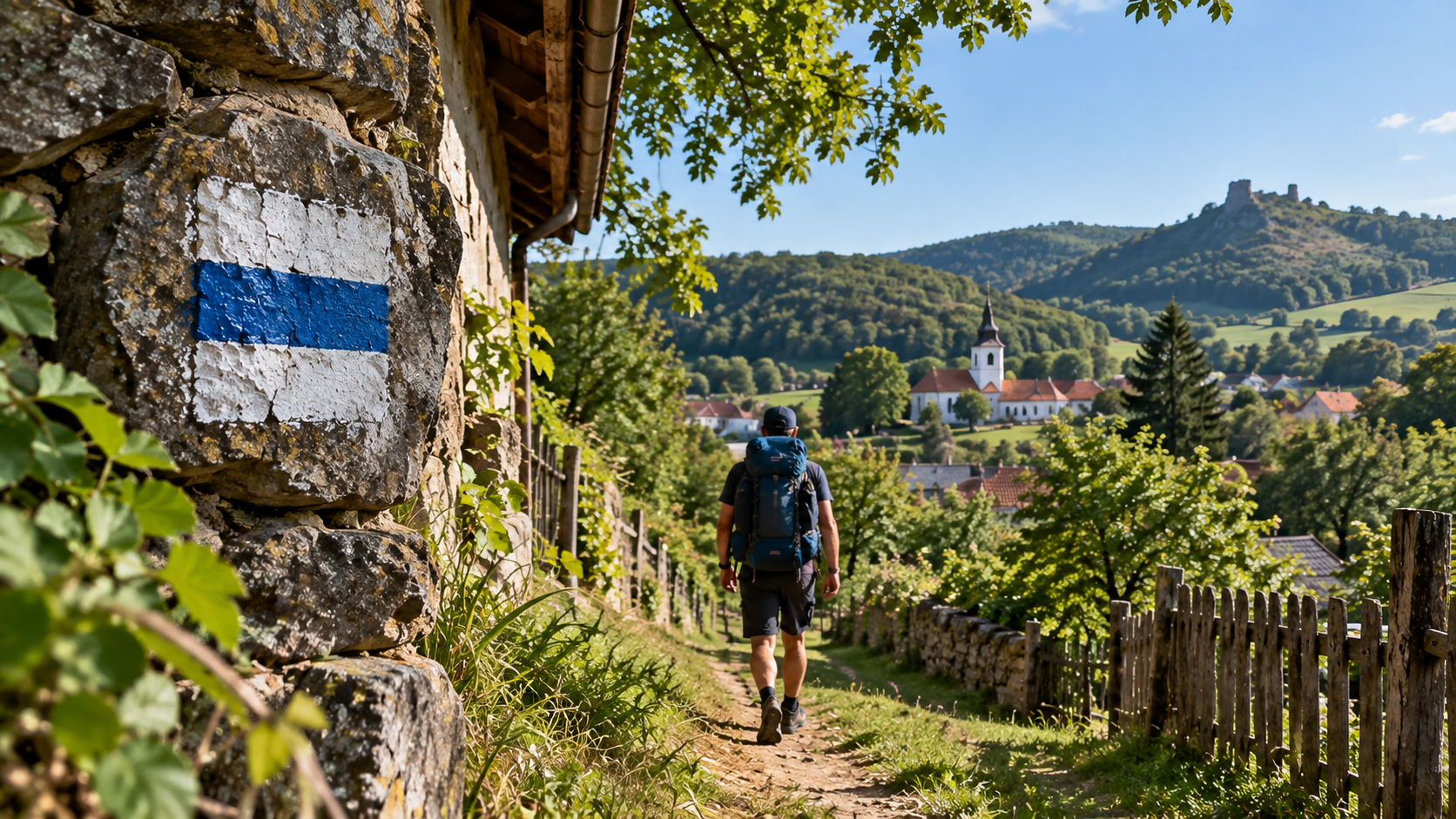
The National Blue Trail, or Országos Kéktúra, is Hungary’s best-known long-distance hiking trail. It runs from Írott-kő in the Kőszeg Mountains all the way to Hollóháza in the Zemplén Mountains. The current official route is 1,171.6 kilometres long, with approximately 31,915 metres of cumulative ascent. However, the Blue Trail does not have to be completed as one continuous multi-week trek, nor does it have to be walked in exactly 27 hiking days. The classic OKT-01–OKT-27 division splits the route into 27 major planning sections, several of which are two- or three-day hikes in their own right. This guide therefore goes far beyond a simple list: all 27 sections are presented individually, with official distance, elevation gain, walking time, major landscapes, characteristic sights and a relevant photograph for every section.
From Írott-kő to Hollóháza, with no compulsory order or direction.
The current official length of the full National Blue Trail.
The total cumulative positive elevation gain along the full route.
On section OKT-21, the route reaches the highest point in Hungary.
- 27 sections do not mean 27 hiking days Several official sections are 50–70 kilometres long, so they are usually divided into shorter daily stages.
- You can start anywhere There is no requirement to begin at Írott-kő, and the sections do not have to be completed in order.
- Both directions are valid The route can be completed from west to east or from east to west.
- You must actually walk the Blue Trail Official completion is not a stamp-collecting road trip: the marked blue-stripe route must be walked.
- Always use the current route Diversions, route changes and checkpoint relocations occur, so check official Blue Trail information before setting off.
Írott-kő – Sárvár
The western gateway of the Blue Trail: from the Kőszeg Mountains all the way to Sárvár
A mountainous beginning, Kőszeg, then increasingly gentle western Hungarian countryside.
The classic western endpoint of the National Blue Trail lies at Írott-kő. From the 882-metre summit, the route descends through the forests of the Kőszeg Mountains towards the town of Kőszeg. The opening kilometres are the most mountainous part of the entire section: woodland, borderland paths and the characteristic mid-mountain environment of the Kőszeg range set the tone for the beginning of the trail.
Beyond Kőszeg, the terrain becomes considerably gentler. The remainder is a much calmer, long-distance walk towards Sárvár. At 71.5 kilometres, this is not a realistic single-day section for most hikers, so it is normally divided into several stages. The relatively modest 555 metres of total ascent also shows how different the mountainous beginning is from the flatter terrain that follows.
Sárvár – Sümeg
A long journey through lower rolling countryside towards the castle hill of Sümeg
One of the least mountainous but longest sections of the National Blue Trail.
The 72.4 kilometres between Sárvár and Sümeg make OKT-02 one of the longest official sections, yet it is also one of the gentlest in terms of elevation gain. The villages, agricultural land, woodland patches and long dirt roads of Kemeneshát and Kemenesalja create a very different experience from the Kőszeg Mountains.
The main challenge is not steepness, but distance. Long, less dramatic connecting sections require a different mindset from a summit hike. As you approach from the west, Sümeg’s castle hill gradually becomes more prominent, providing one of the strongest visual endpoints on this section.
Sümeg – Keszthely
Castle ruins, forested ridges and arrival at the western end of Lake Balaton
Tátika, Rezi, the Hévíz area and the cultural sights of Keszthely.
After Sümeg, the route becomes noticeably more mountainous again. OKT-03 crosses wooded ridges, passes close to castle ruins and links smaller settlements on its way towards the western basin of Lake Balaton. Tátika and Rezi castles are among the best-known historic sights of this section; reaching them may require a short detour from the current official route.
The trail also passes through the wider Hévíz area before reaching Keszthely, where the atmosphere of the Balaton region becomes unmistakable. Festetics Palace, its park and Keszthely’s town centre can easily fill several additional hours, so many hikers plan more here than simply walking through as quickly as possible.
Keszthely – Tapolca
A long forest crossing of the Keszthely Mountains towards the gateway of the volcanic witness hills
A forest-dominated section ending with the first views of the volcanic hills of the Tapolca Basin.
OKT-04 leaves Keszthely and enters the interior of the Keszthely Mountains. The urban beginning soon gives way to long, continuous woodland routes. The character of much of the section comes not from one single major attraction, but from the forested mountain range itself.
As the trail continues east, the witness hills of the Tapolca Basin become increasingly prominent. This section therefore acts as a transition from the woodland landscape of western Balaton to the volcanic, vineyard-covered and panoramic terrain of the following stages. At nearly 30 kilometres with 560 metres of ascent, it can form a substantial but manageable full hiking day.
Tapolca – Badacsonytördemic
A short but highly scenic section across Szent György Hill and the Szigliget area
Basalt columns, vineyards, castle views and classic Balaton Uplands scenery.
OKT-05 is relatively short among the 27 major sections, but it is exceptionally dense in scenery. From Tapolca’s Malom Lake area, the trail heads towards Szent György Hill, where basalt formations, vineyards and wide views follow one another.
The route then continues through the Szigliget area to Badacsonytördemic. Szigliget Castle and the ruins of the Avas church are among the strongest historic highlights of the section. At just 17.1 kilometres, this can be an excellent first National Blue Trail day, although the climb on Szent György Hill is still noticeable.
Badacsonytördemic – Nagyvázsony
Badacsony, the Káli Basin and volcanic witness hills: one of the most panoramic sections of the Blue Trail
Repeated climbs, basalt, vineyards, Fekete Hill and constantly changing views of Lake Balaton.
The sixth section starts at Badacsonytördemic with an immediate climb up the steep slopes of Badacsony. The Bujdosók Stairs, basalt formations and views over Lake Balaton are followed by a sequence of other volcanic landscapes: Káptalantóti, Csobánc, Szentbékkálla, the Káli Basin and Fekete Hill all contribute a different character.
Beyond Balatonhenye, the landscape gradually becomes more characteristic of the Bakony, before reaching Nagyvázsony. The 49.3 kilometres include 1,575 metres of ascent, so this is clearly a multi-day major section. The exposed slopes also mean that heat and water supply deserve particular attention in hot, sunny weather.
Nagyvázsony – Városlőd
Leaving the Balaton Uplands and entering the forested world of the Bakony
Kab Hill, Úrkút and large continuous forests define the section.
After Nagyvázsony, the National Blue Trail finally leaves the volcanic witness hills of the Balaton Uplands and enters increasingly continuous Bakony forest. The main high point of the section is the Kab Hill area, which is reached after a substantial climb.
After Kab Hill, the route passes Úrkút, then continues through rolling forest terrain towards Városlőd. With 24.7 kilometres and 515 metres of ascent, this already forms a proper full hiking day. The section also acts as a transition between the Balaton Uplands and the higher forests of the Northern Bakony.
Városlőd – Zirc
Across the higher, beech-covered interior of the Bakony
Stream valleys, Bakonybél, Kőris Hill and Zirc.
The section between Városlőd and Zirc shows the more mountainous side of the Bakony. Stream valleys, old forest tracks, high beech woods and small Bakony villages follow one another. The route also reaches the Bakonybél area, before climbing towards Kőris Hill.
At 709 metres, Kőris Hill is the highest point of the Bakony, making it a natural climax of this section. The route is 39.8 kilometres long with 1,105 metres of ascent, so the classic section is best split into at least two days. Zirc is one of the best transport and service hubs in the Bakony.
Zirc – Bodajk
The Gaja stream, gorges and drier plateaus in the Eastern Bakony
Római-fürdő, Tés, the Gaja Valley and a long, varied crossing of the Bakony.
One of the greatest strengths of OKT-09 is the constant change in landscape. The wooded, water-rich valleys of the Gaja stream give way to drier, more open plateaus, before returning to forested and gorge-like terrain.
Római-fürdő is one of the Gaja’s most impressive rocky gorges and can be reached by a short detour from the official route. Around Tés, the plateau and its famous windmills create a very different landscape, before the Gaja Valley becomes more enclosed again towards Bodajk. At 57.4 kilometres with 1,220 metres of ascent, this should be planned as a multi-day section.
Bodajk – Szárliget
A long, quiet crossing of the Vértes forests
Limestone hills, Gánt, Várgesztes and historic castle ruins.
After Bodajk, the Blue Trail enters the forested limestone landscape of the Vértes. Gánt’s mining heritage, Várgesztes, smaller castle ruins and long, quiet forest sections define the character of the route.
The Vértes is not particularly high, but its rolling terrain still accumulates 1,370 metres of ascent over 55.7 kilometres. Water points and daily exit options should be planned in advance, as long stretches pass through areas with few settlements directly on the route. Vitányvár is one of the range’s most scenic ruins; if you plan a dedicated detour, check the current access route separately.
Szárliget – Dorog
Gerecse ridges, limestone paths and one of the largest cumulative climbs
Pusztamarót, Mogyorósbánya and Nagy-Gete make this a memorable section.
The section between Szárliget and Dorog is already one of the more demanding major stages even on paper: almost 69 kilometres with 2,175 metres of ascent. The Gerecse is a relatively low mountain range, but the constant succession of climbs and descents creates substantial physical load.
Pusztamarót, Mogyorósbánya and Nagy-Gete are among the route’s most characteristic points. The limestone terrain and sometimes drier hillsides feel different from the large beech forests of the Bakony. This section is best divided over several days, with particular attention to water supply in summer.
Dorog – Piliscsaba
A shorter stage among the limestone formations of the Pilis and past Klastrompuszta
One of the classic OKT sections that is relatively easy to complete as a single day hike.
After the long Gerecse section, OKT-12 is much more compact. From Dorog, the trail crosses the foothills of the Pilis, limestone slopes and forest paths towards Klastrompuszta, an important historic location connected to the Hungarian Pauline Order.
At only 18.4 kilometres with 530 metres of ascent, this is one of the classic sections that works particularly well as a single-day hike. The terrain, however, is not completely flat: the short but distinct Pilis climbs still provide a proper hiking challenge.
Piliscsaba – Hűvösvölgy
Nagy-Szénás, Zsíros-hegy and the Remete Gorge on the edge of Budapest
Protected natural areas and excellent panoramas immediately beside the capital.
After Piliscsaba, the Blue Trail climbs to the open, protected dolomite grasslands of Nagy-Szénás. The exposed summit area offers broad views over the Buda Hills and nearby settlements, before the trail continues towards Zsíros-hegy and woodland terrain.
One of the characteristic areas on the approach to Hűvösvölgy is the Remete Gorge. The route links settlements with good public transport, making it one of the logistically easier parts of the National Blue Trail. Nevertheless, 645 metres of ascent still make it a full mountain hiking day.
Hűvösvölgy – Rozália téglagyár
The shortest classic OKT section, entirely within Budapest’s green hills
Árpád Lookout, Hármashatár-hegy and Guckler Lookout.
At just 14.1 kilometres, OKT-14 is the shortest section in the classic 27-part division, but it is not a flat city walk. From Hűvösvölgy, the route follows the Glück Frigyes path and Határnyereg, then continues towards Árpád Lookout and Fenyőgyöngye.
Hármashatár-hegy and Guckler Lookout offer broad panoramas over Budapest, before the trail continues through Virágos-nyereg towards Rozália téglagyár. With excellent public transport and a short distance, this is one of the most practical first Blue Trail sections.
Rozália téglagyár – Dobogókő
The Kevély hills, Dera Gorge and a long climb to Dobogókő
One of the steepest shorter sections of the National Blue Trail.
OKT-15 is only 22.6 kilometres long, yet it contains more than 1,000 metres of ascent. Near Pilisborosjenő, the Teve-szikla area is followed by Kevély-nyereg and Csobánka, after which the trail begins another substantial climb.
Around Pilisszentkereszt, Dera Gorge is one of the area’s best-known natural attractions, followed by the Zsivány Rocks and the final climb to Dobogókő. It is easy to underestimate this section based on distance alone: the 1,060 metres of ascent make it a physically demanding single-day route.
Dobogókő – Visegrád
From the heart of the Visegrád Mountains all the way down to the Danube
Forested ridges, clearings, Danube Bend views and a long descent.
From Dobogókő, the Blue Trail crosses the forested interior of the Visegrád Mountains towards the Danube Bend. This section is not built around one single major sight: instead, long woodland walking, ridgetop clearings and occasional panoramic openings define the experience.
As Visegrád approaches, the Danube and the steep edge of the Visegrád Mountains become increasingly prominent. At Visegrád, the trail reaches the western bank of the river. The next section begins at Nagymaros, so crossing the Danube is a separate logistical element.
Nagymaros – Nógrád
The major Börzsöny section: Julianus Lookout, Nagy-Hideg-hegy and Csóványos
Serious mountain elevation and one of the most rewarding ridge-style sections of the National Blue Trail.
From Nagymaros, the route climbs steeply into the southern Börzsöny. Julianus Lookout on Hegyes-tető offers one of the most famous panoramas over the Danube Bend, but the section has only just begun at this point.
Deeper in the Börzsöny, Nagy-Hideg-hegy and the 938-metre Csóványos follow, before a long forest route descends towards Nógrád. At 40.3 kilometres with 1,745 metres of ascent, this classic section is clearly best split over several days. Among the more demanding mountain sections of the Blue Trail, it is also one of the most memorable.
Nógrád – Becske
After the Börzsöny, the rolling, village-dotted hills of the Cserhát take over
Less alpine in appearance, but with many small climbs that add up over a long distance.
After Nógrád, the higher mountains of the Börzsöny quickly recede, and the long crossing of the Cserhát begins. The landscape is lower, but continuously rolling: patches of forest, pastures, fields and small villages alternate throughout the section.
The Cserhát can easily be underestimated because there is no single enormous climb, yet over 59.2 kilometres the route accumulates 1,880 metres of ascent. The strength of the section is not one major tourist attraction, but its quiet, less crowded rural hiking atmosphere.
Becske – Mátraverebély
Hollókő, Palóc villages and the classic section with the greatest cumulative ascent
A long, continuously rolling journey through the eastern Cserhát.
OKT-19 is the longest section in the classic division and, with 2,400 metres of cumulative ascent, also the one with the greatest total climb. The Cserhát is not a high mountain range, but the constant succession of climbs and descents over nearly 74 kilometres creates substantial physical demand.
The major highlight is Hollókő, where the UNESCO-listed Old Village, the castle and the surrounding Cserhát landscape form a unique combination. The official section is best divided into several shorter days, and because public transport is less frequent, daily endpoints should be selected carefully.
Mátraverebély – Mátraháza
Entering the Mátra: long ridges and Galyatető
A shorter distance, but a serious 1,320 metres of ascent.
At Mátraverebély, the Blue Trail reaches the Mátra, and the character of the route changes immediately. The 26 kilometres contain 1,320 metres of ascent, making it clear that this is a genuine mountain stage.
After the long ridges of the western and central Mátra, Galyatető becomes one of the main high points. The mountain range’s dense forests, higher saddles and cooler microclimate contrast strongly with the more open rolling landscape of the Cserhát. Mátraháza provides a useful transport hub before the next stage.
Mátraháza – Sirok
Kékestető: the highest point of the National Blue Trail
Hungary’s 1,014-metre high point, Mátra ridges and a long descent towards Sirok.
From Mátraháza, the National Blue Trail climbs to Kékes, Hungary’s highest point at 1,014 metres. This is the absolute high point of the entire Blue Trail and one of its most important symbolic landmarks.
Beyond Kékestető, the eastern ridges of the Mátra and rockier mountain sections follow. The Sas-kő area offers broad panoramas, before the route gradually descends towards Sirok. The 25.6 kilometres and more than 1,000 metres of ascent make this a demanding single-day mountain hike.
Sirok – Szarvaskő
Transition between the Mátra and the Bükk
Sirok Castle, open rolling hills and a short, manageable classic section.
OKT-22 is geographically particularly interesting: it links the higher massif of the Mátra with the wider Bükk region. Sirok’s castle, built on a rocky hill, provides a strong historic starting point, before the route enters lower, more open hills and ridges.
At 17.9 kilometres with 585 metres of ascent, this is one of the shorter classic Blue Trail stages. It works well as an independent single-day hike and provides a logical transition between the serious Mátra ridge walking and the long Bükk section that follows.
Szarvaskő – Putnok
A long, wild crossing of the Bükk Mountains
High plateaus, vast beech forests, rock shelters and 2,255 metres of cumulative ascent.
The route between Szarvaskő and Putnok is one of the most mountainous parts of the entire National Blue Trail. It crosses the high forests, plateaus and deep valleys of the Bükk, remaining far from major settlements for long periods.
The Cserepes-kő area and its rock shelter are particularly characteristic Bükk locations. The 62.2 kilometres include 2,255 metres of ascent, making OKT-23 not only long, but one of the most physically demanding major sections. Water, accommodation and daily stopping points require especially careful planning here.
Putnok – Bódvaszilas
From the Borsod hills into the limestone world of the Aggtelek Karst
Open plateaus, karst formations, small villages and an entirely new landscape character.
After Putnok, the Bükk massif is left behind, and the route turns towards the Borsod Hills and then the Aggtelek Karst. The region’s limestone landforms, sinkholes, open grasslands and forests create a completely different atmosphere from the high beech forests of the previous section.
The area around Aggtelek, Jósvafő and Szögliget forms one of Hungary’s most distinctive karst landscapes. Baradla Cave is a separate visitor attraction, so the Blue Trail does not pass through it as a cave tour, but the surface karst landscape strongly defines the entire area. The 62 kilometres and 1,630 metres of ascent again call for a multi-day plan.
Bódvaszilas – Boldogkőváralja
The Szalonna Karst, Cserehát and the tiny villages of north-eastern Hungary
One of the longest major sections, ending at the gateway to the Zemplén Mountains.
OKT-25 leaves Bódvaszilas and crosses the less frequently visited, small-village landscape of the Szalonna Karst and Cserehát. This is not one of the highest parts of the Blue Trail, but the 70.8-kilometre distance and 1,525 metres of ascent still make it a substantial multi-day journey.
After the rolling hills and tiny settlements of the Cserehát, the route approaches the Hernád Valley, and the unmistakable Boldogkő Castle appears above Boldogkőváralja. The castle forms a strong visual boundary: from here, the Zemplén Mountains begin.
Boldogkőváralja – Nagy-nyugodó
Entering the dark forests and wild mountain terrain of the Zemplén
Regéc, narrow valleys, long forest ridges and increasingly mountainous terrain.
After Boldogkőváralja, the National Blue Trail enters its final major mountain range. The Zemplén’s long, continuous forests, volcanic ridges, narrow stream valleys and sparsely populated areas feel considerably wilder than the Cserehát.
The Regéc area is one of the most important cultural points of the section. The castle stands high above the surroundings and reflects the rugged topography of the Zemplén. The 51.3 kilometres contain 1,640 metres of ascent, so the route is best divided into several days, especially if you also want to visit castles and other side attractions.
Nagy-nyugodó – Hollóháza
Füzér, Nagy-Milic and the final Zemplén kilometres to Hollóháza
The final demanding mountain section for hikers completing the trail from west to east.
The 27th classic section is not an easy final stroll: over 51.9 kilometres, it accumulates 1,845 metres of ascent. In the northern, borderland part of the Zemplén, long forest climbs and descents follow one another.
Füzér Castle is one of the most dramatically positioned castles on the entire National Blue Trail. Beyond it, the 895-metre Nagy-Milic provides the final serious mountain obstacle, before the route descends towards Hollóháza. For west-to-east hikers, this is where the 1,171.6-kilometre National Blue Trail ends; in the opposite direction, of course, this is the starting point.
The hiking movement can be completed in either direction. If you start in Hollóháza, OKT-27 becomes your first section, and you can continue towards Írott-kő.
The 27 sections are only a planning system: official completion requires walking the entire Blue Trail route
You do not have to complete the sections in order, but you must visit all required checkpoints
For official validation, a personal official Blue Trail booklet is used.The National Blue Trail is a route-following hiking movement. For official completion, it is not enough to visit the checkpoints individually: the blue-stripe route between them must also be walked.
The Blue Trail changes from time to time. Forestry, nature conservation, land ownership or infrastructure may cause sections to be rerouted. Before every hike, check the current official route and checkpoint locations.
The classic 27 sections are not a 27-day hiking plan
Match your daily distance to the terrain, transport and your own pace
Twenty kilometres in the Mátra is not the same as twenty kilometres in Kemenesalja.Major units such as OKT-01, OKT-02, OKT-11, OKT-19, OKT-23, OKT-24 and OKT-25 were not designed as normal single-day hikes. The official section boundary is a planning reference, not a compulsory daily destination.
Which sections are good for a first taste of the Blue Trail?
Your first Blue Trail hike does not have to be OKT-01.| If you are looking for… | Suggested section | Why? |
|---|---|---|
| An easy-to-organise first OKT day | OKT-14 | 14.1 km, excellent Budapest transport and plenty of views. |
| A short, very scenic section | OKT-05 | Szent György Hill, Szigliget and the Balaton Uplands. |
| Large forests | OKT-08 | Bakonybél, Kőris Hill and extensive beech woods. |
| Danube Bend and mountains | OKT-17 | Julianus Lookout, Csóványos and the Börzsöny. |
| A serious mountain challenge | OKT-20 or OKT-21 | The Mátra, Galyatető and Kékestető. |
| Wild forests | OKT-23 | One of the longest and most mountainous Blue Trail sections through the Bükk. |
| Karst landscape | OKT-24 | The Aggtelek Karst and distinctive limestone terrain. |
| Castles and the Zemplén | OKT-26–27 | Regéc, Füzér, Nagy-Milic and Hollóháza. |
27 sections, 1,171.6 kilometres, but there is no single compulsory way to complete the National Blue Trail
Írott-kő, the Balaton Uplands and the Bakony
The first ten sections run from the Kőszeg Mountains through the volcanic witness hills of the Balaton Uplands and the great forests of the Bakony to the gateway of the Vértes. This part includes some of the finest Lake Balaton panoramas on the route as well as several very long, but less alpine-style sections.
Gerecse, Pilis, Buda Hills, Danube Bend and Börzsöny
Here, the trail crosses Budapest’s green hill country, Dobogókő, Visegrád and the higher ridges of the Börzsöny. The short OKT-14 and the demanding OKT-17 show just how different Blue Trail hiking days can be.
Cserhát, Mátra, Bükk, Aggtelek Karst and Zemplén
The eastern sections contain many of the route’s greatest cumulative climbs, the 1,014-metre Kékes, the vast forests of the Bükk, Hollókő, the Aggtelek Karst, Regéc, Füzér and finally Hollóháza. Completing the National Blue Trail is less about speed than about planning and persistence.

Sources and photos
This article uses the classic 27-section division of Hungary’s National Blue Trail. The route, exact section lengths, checkpoints and individual trail sections may change over time. Before a specific hike, always use the latest official information from the Hungarian Hiking Association and the National Blue Trail.
- Kéktúra – official National Blue Trail website
- Hungarian Hiking Association / Természetjáró – National Blue Trail
- Kéktúra Knowledge Base – What is the Blue Trail?
- Kéktúra Knowledge Base – What does “section” mean?
- Kéktúra Knowledge Base – First steps on the Blue Trail
Photos used for the 27 sections: the images are Wikimedia Commons files. The exact author, licence and reuse conditions are available on the linked file description page for each image.
- OKT-01 – Írott-kő National Blue Trail checkpoint
- OKT-02 – Sümeg Castle
- OKT-03 – Tátika Castle
- OKT-04 – Keszthely Mountains
- OKT-05 – Szent György Hill
- OKT-06 – Badacsony panorama
- OKT-07 – Kab Hill
- OKT-08 – Kőris Hill National Blue Trail checkpoint
- OKT-09 – Római-fürdő, Gaja Gorge
- OKT-10 – Vitányvár
- OKT-11 – Gerecse
- OKT-12 – Klastrompuszta
- OKT-13 – Nagy-Szénás
- OKT-14 – Hármashatár-hegy National Blue Trail checkpoint
- OKT-15 – Dobogókő
- OKT-16 – Visegrád and the Danube
- OKT-17 – Csóványos
- OKT-18 – Nógrád Castle
- OKT-19 – Hollókő Castle
- OKT-20 – Galyatető National Blue Trail checkpoint
- OKT-21 – Kékestető
- OKT-22 – Sirok Castle
- OKT-23 – Cserepes-kő rock shelter
- OKT-24 – Aggtelek Karst landscape near Szögliget
- OKT-25 – Boldogkő Castle
- OKT-26 – Regéc Castle
- OKT-27 – Füzér Castle