Europe’s Highest Points by Country — 47 Countries, 45 High Points
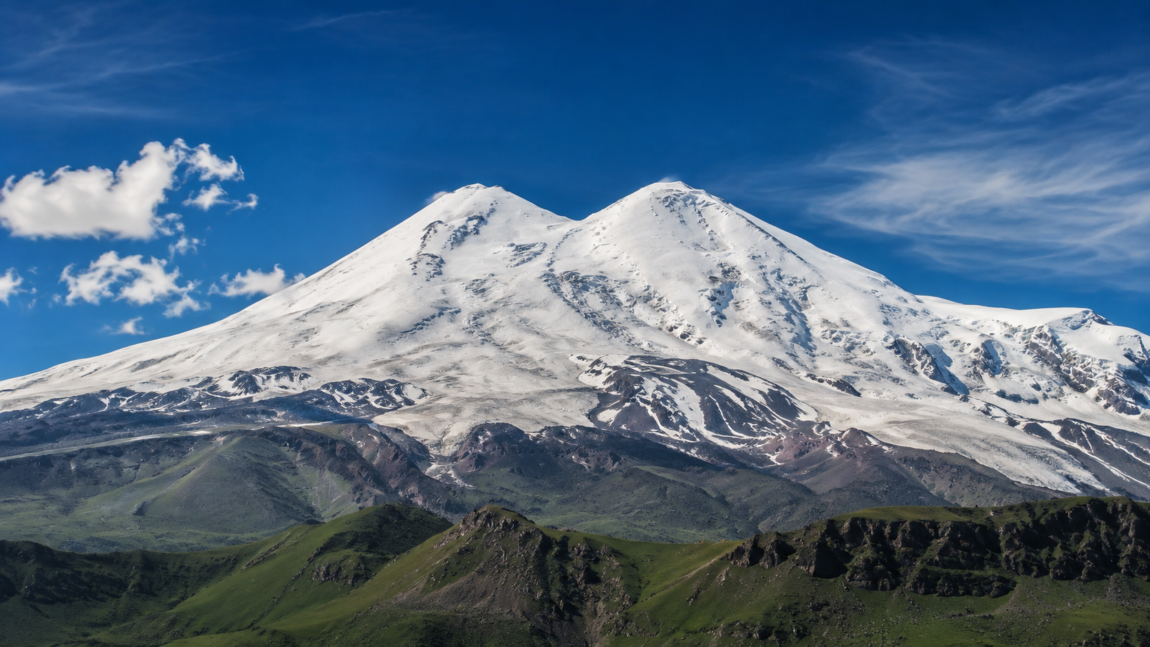
From Elbrus at 5,642 metres to Vatican City at roughly 75 metres, Europe’s national high points span almost every kind of terrain imaginable. Some are simple walks, others are long mountain hikes, and several are serious alpine objectives involving glaciers, exposure or technical climbing. This guide brings 47 countries into one consistent geographical framework and explains not only which point is highest, but what reaching it actually involves.
- Define EuropeUse one consistent geographical rule.
- Check the objectiveA high point may be a walk, hike or alpine climb.
- Respect the terrainAltitude alone does not describe difficulty.
- Verify accessBorder and local rules can matter as much as the route.
- Progress graduallyBuild from hiking objectives towards technical peaks.
What counts as a European national high point?
The answer depends on the geographical rule
Islands, overseas territory, the Caucasus and transcontinental states make the list less obvious than it first appears.Spain’s highest point as a state is Teide in the Canary Islands, Portugal’s is Pico in the Azores, and Turkey’s is Mount Ararat. Yet none of those locations lies within geographical Europe. For a hiking list focused on Europe itself, a different set of high points is more useful.
Geographical Europe
Spain: Mulhacén. Portugal: Torre. Netherlands: Vaalserberg. Denmark: Møllehøj. Turkey: Mahya Dağı in the European part of the country.
Entire territory of the state
Spain would use Teide, Portugal Pico, the Netherlands Mount Scenery, and Turkey Mount Ararat. The Kingdom of Denmark would also change dramatically if Greenland were included.
The Caucasus is the biggest classification question
This version follows the convention that includes Russia and Elbrus in Europe.With this convention, Elbrus is the highest summit in Europe at 5,642 metres. Georgia, Armenia and Azerbaijan are not included in this 47-country version because their classification depends on where the Europe–Asia boundary is drawn.
Europe’s ten highest national high points
The ranking changes from hiking to mountaineering very quickly
Elevation alone hides enormous differences in exposure, glaciers and technical difficulty.| Rank | Country | High point | Elevation |
|---|---|---|---|
| 01 | Russia | Elbrus | 5,642 m |
| 02 | France / Italy | Mont Blanc | ≈4,806 m |
| 03 | Switzerland | Dufourspitze | 4,634 m |
| 04 | Austria | Großglockner | 3,798 m |
| 05 | Spain | Mulhacén | 3,479 m |
| 06 | Germany | Zugspitze | 2,962 m |
| 07 | Andorra | Coma Pedrosa | 2,942 m |
| 08 | Bulgaria | Musala | 2,925 m |
| 09 | Greece | Mount Olympus – Mytikas | 2,918 m |
| 10 | Slovenia | Triglav | 2,864 m |
Mulhacén or Musala can be hiking objectives in suitable conditions, while Mont Blanc, Dufourspitze and Großglockner belong to a completely different category. The same “national high point” label can therefore describe anything from a long mountain day to serious alpine climbing.
A high point can still be a hiking objective
Mount Olympus shows how quickly hiking terrain can become exposed near the summit.
The highest European point in 47 countries
47 countries, one consistent geographical approach
Ice-covered summits and borderline cases can vary slightly between measurements or classification systems.The table uses the most commonly quoted rounded elevations from the supplied list. On snow- and ice-covered summits such as Mont Blanc or Kebnekaise, measured elevation can change over time.
| Country | Highest point | Elevation | Mountain range | Character |
|---|---|---|---|---|
| Russia | Elbrus | 5,642 m | Caucasus | Mountaineering |
| France | Mont Blanc | ≈4,806 m | Alps | Mountaineering |
| Italy | Mont Blanc / Monte Bianco | ≈4,806 m | Alps | Mountaineering |
| Switzerland | Dufourspitze | 4,634 m | Monte Rosa, Alps | Mountaineering |
| Austria | Großglockner | 3,798 m | Hohe Tauern, Alps | Mountaineering |
| Spain | Mulhacén | 3,479 m | Sierra Nevada | Difficult hike |
| Germany | Zugspitze | 2,962 m | Alps | Various routes |
| Andorra | Coma Pedrosa | 2,942 m | Pyrenees | Difficult hike |
| Bulgaria | Musala | 2,925 m | Rila | Hike |
| Greece | Mount Olympus – Mytikas | 2,918 m | Mount Olympus | Exposed summit hike |
| Slovenia | Triglav | 2,864 m | Julian Alps | Protected sections |
| Albania | Golem Korab | 2,764 m | Korab Mountains | Hike |
| North Macedonia | Golem Korab | 2,764 m | Korab Mountains | Hike |
| Kosovo | Velika Rudoka / Rudoka e Madhe | 2,660 m | Šar Mountains | Hike |
| Slovakia | Gerlachovský štít | 2,655 m | High Tatras | Guided / alpine |
| Liechtenstein | Vorder Grauspitz | 2,599 m | Rätikon | Difficult hike |
| Romania | Moldoveanu | 2,544 m | Făgăraș Mountains | Long hike |
| Montenegro | Zla Kolata | 2,534 m | Prokletije | Difficult hike |
| Poland | Rysy – north-western summit | 2,499 m | High Tatras | Difficult hike |
| Norway | Galdhøpiggen | 2,469 m | Jotunheimen | Hike / glacier route |
| Bosnia and Herzegovina | Maglić | 2,386 m | Dinaric Alps | Difficult hike |
| Serbia | Midžor | 2,169 m | Stara Planina | Hike |
| Iceland | Hvannadalshnúkur | 2,110 m | Öræfajökull | Glacier / alpine |
| Sweden | Kebnekaise – northern summit | ≈2,097 m | Scandinavian Mountains | Long hike |
| Ukraine | Hoverla | 2,061 m | Carpathians | Hike |
| Portugal | Torre | 1,993 m | Serra da Estrela | Easy |
| Cyprus | Mount Olympus / Chionistra | 1,952 m | Troodos | Easy |
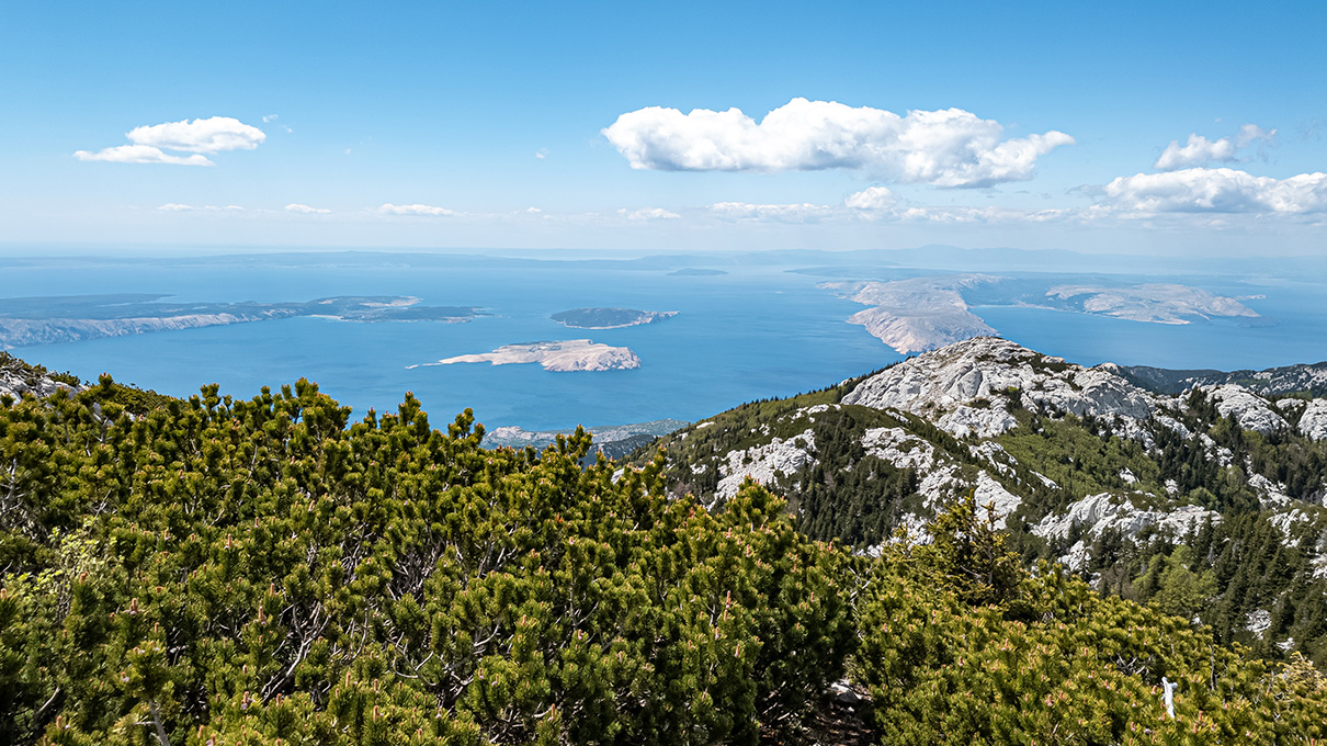
| Croatia | Dinara – Sinjal | 1,831 m | Dinaric Alps | Hike |
| Czechia | Sněžka | 1,603 m | Giant Mountains | Hike |
| United Kingdom | Ben Nevis | 1,345 m | Scottish Highlands | Hike |
| Finland | Halti – Finnish high point | 1,324 m | Scandinavian Mountains | Long, wilderness |
| Ireland | Carrauntoohil | 1,039 m | MacGillycuddy’s Reeks | Difficult hike |
| Turkey – European part | Mahya Dağı | 1,031 m | Yıldız / Strandzha | Easier hike |
| Hungary | Kékes | 1,014 m | Mátra | Easy hike |
| San Marino | Monte Titano | 739 m | Apennines | Walk |
| Belgium | Signal de Botrange | 694 m | Ardennes | Walk |
| Luxembourg | Kneiff | 560 m | Ardennes | Walk |
| Moldova | Dealul Bălănești | 430 m | Moldavian Hills | Walk |
| Belarus | Dzyarzhynskaya Hara | 345 m | Minsk Upland | Walk |
| Netherlands – European part | Vaalserberg | 322.4 m | Limburg | Walk |
| Estonia | Suur Munamägi | 318 m | Haanja Upland | Walk |
| Latvia | Gaiziņkalns | 312 m | Vidzeme | Walk |
| Lithuania | Aukštojas | 294 m | Medininkai Upland | Walk |
| Malta | Ta’ Dmejrek | 253 m | Dingli Cliffs | Walk |
| Denmark | Møllehøj | 171 m | Jutland | Walk |
| Monaco | Chemin des Révoires high point | ≈162 m | Mont Agel slope | Urban walk |
| Vatican City | Vatican Hill high point | ≈75 m | Rome | Urban walk |
Why some countries have more than one “correct” answer
Geography changes the answer before the hiking even begins
These examples explain why national high-point lists often differ.Which national high points are suitable for hikers?
A national high point is not automatically a hiking summit
The route type matters more than the number on the altimeter.High, but not necessarily technical
Musala, Mulhacén, Galdhøpiggen, Moldoveanu, Midžor, Hoverla and Ben Nevis are primarily hiking objectives on suitable routes and in suitable conditions, although their length, weather exposure and terrain vary considerably.
A different category altogether
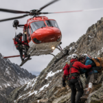
Elbrus, Mont Blanc, Dufourspitze, Großglockner and Hvannadalshnúkur may involve glaciers, ropework, protection, avalanche hazards or high-altitude risk. Treating them as simply “big hikes” is a serious mistake.
Gerlachovský štít is a special case
The highest summit in the High Tatras is not simply the end of a marked hiking trail.The normal ascent should be treated as an organised, guided high-mountain objective. Current Tatras regulations should always be checked before setting out.
Triglav: a national symbol with protected sections
The route can feel much more serious than its elevation alone suggests.
Six national high points that are not as obvious as they look
The map, the ice and the border can all change the story
These are the details most likely to surprise first-time high-point collectors.How to start collecting European national high points
Build the project in layers
The smartest progression is based on terrain and logistics, not simply on elevation.- Start nearby and keep it simpleKékes, Sněžka, Signal de Botrange or Monte Titano make straightforward first national high points.
- Move on to proper mountain hikesMusala, Midžor, Hoverla, Ben Nevis or Mulhacén offer a much more substantial mountain day without automatically becoming technical climbs.
- Prepare separately for border objectivesKorab, Rysy, Zla Kolata or Halti may require extra attention to access, border rules and route planning.
- Do not confuse hiking with mountaineeringGlaciers, altitude and technical terrain demand a completely different level of preparation.
- Check current conditions every timeSnow, closures, guiding requirements, border regulations and route conditions can change.
Which national high point would we choose first?
Three strong first objectives
High enough to feel like a real summit day, without immediately entering the hardest alpine category.If the aim is the “Crown of Europe” itself, there is little reason to work through the list in elevation order. Its appeal lies in the contrast: one trip may involve a serious mountain day, while the next high point is a Baltic hill or a walk through a microstate.
Frequently asked questions about Europe’s national high points
The questions behind the list
Most disagreements come from geography, shared summits and the difference between hiking and mountaineering.Is Elbrus the highest mountain in Europe?
In the geographical convention used by this article, yes. Elbrus is included in Europe and is the highest summit on the list at 5,642 metres.
Why does Spain use Mulhacén rather than Teide?
Teide is the highest point of the Spanish state as a whole, but it lies in the Canary Islands. This article uses the highest point within geographical Europe, which is Mulhacén.
Why are there 47 countries but only 45 separate high points?
Mont Blanc appears for both France and Italy, while Golem Korab appears for both Albania and North Macedonia. Those two shared objectives reduce the number of separate mountains/high points to 45.
Can every European national high point be reached as a normal hike?
No. Some are walks or mountain hikes, while others involve glaciers, ropework, protected terrain, high-altitude risk or guided alpine climbing.
Why can Sweden’s highest point change?
Kebnekaise’s southern summit is glacier-covered and has changed in elevation as the ice has melted. The northern rocky summit is now the stable highest point in the supplied list.
Is Finland’s highest point a mountain summit?
No. Finland’s highest point lies on the slopes of Halti at 1,324 metres, while the mountain’s actual summit lies in Norway.
“National high point” does not describe difficulty.
A walk, a long mountain hike, an exposed protected route and a glaciated alpine climb can all appear in the same project. Route character, current conditions and local regulations matter more than the ranking.
Build experience before elevation.
Start with straightforward hiking objectives, progress to longer and more exposed mountain days, and treat the technical alpine summits as a separate discipline requiring the appropriate skills and preparation.