Hungary's Landscapes and Mountain Ranges: A Guide to the Best Hiking Regions
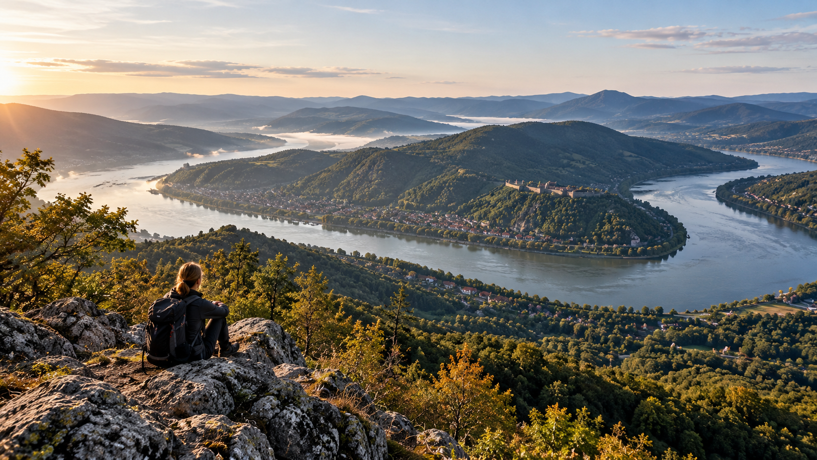
Hungary’s mountains cannot be captured in a single panorama. The high forested ridges of the Mátra, the white limestone cliffs of the Bükk, the deep valleys of the Börzsöny, the castle-topped hills of Zemplén and the isolated volcanic hills of the Balaton Uplands offer entirely different experiences. In this guide, we do more than list the regions: we explain why each is worth visiting, what kind of terrain to expect and how to choose a route. Whenever we mention a distinctive location, its accompanying photograph shows that very landscape.
Not all are mountainous: the Great and Little Hungarian Plains are also part of the country’s geography.
Hungary’s highest point is in the Mátra Mountains.
Distance, ascent, terrain and weather together determine a hike’s real difficulty.
Each chapter shows real places in the Hungarian landscape it describes.
- Hungary’s mountain regions are remarkably varied.The volcanic ranges of the north, the limestone uplands of Transdanubia and the hills around Lake Balaton offer distinct hiking experiences.
- Hungary’s highest point is Kékes (1,014 m).But the most demanding hike does not necessarily lead to the highest summit.
- Choose the landscape you want to experience.Panoramas, gorges, castles, waterfalls, caves or peaceful forests all call for different routes.
- Check your chosen hike.Review current trail markings, elevation gain, weather, opening hours and nature conservation rules.
Hungary’s major landscape regions: where do the mountains begin?
The six major regions are not the same as a list of mountain ranges
First, let’s establish the geographical framework, then explore what makes a Mátra summit walk different from a Bakony valley hike.Hungary is generally divided into six major landscape regions: the Great Hungarian Plain (Alföld), the Little Hungarian Plain (Kisalföld), the Alpine Foothills (Alpokalja), the Transdanubian Hills, the Transdanubian Mountains and the Northern Hungarian Mountains. These are geographical regions, not hiking categories: plains can contain hills, and the boundaries between hill country and mountains vary slightly between geographical classifications.
Börzsöny, Cserhát, Mátra, Bükk and Zemplén: a diverse mix of volcanic and limestone landscapes with substantial elevation differences.
Bakony, Balaton Uplands, Vértes, Gerecse, Pilis and Buda Hills: ridges, caves, gorges and plateaus.
The Kőszeg and Sopron Mountains: cooler, forested hiking areas along Hungary’s western border.
The Mecsek and Villány Mountains and their surrounding hills: shorter climbs, rock formations and some Mediterranean-influenced vegetation.
Lowland walks through grasslands, floodplain forests and sand dunes; little elevation gain but distinctive habitats.
Flat river landscapes and nature trails, including the Szigetköz and Lake Fertő areas.
The Visegrád Mountains illustrate this complexity: geologically and in their landscape history, they are a volcanic region related to the Börzsöny, although hikers often group them with the neighboring Pilis. The Pilis is predominantly a limestone range, so the two names should not be confused.
Hungary’s highest point is Kékes in the Mátra Mountains, at 1,014 metres. Most of the country’s mountains and hills are relatively modest in elevation, yet gorges, steep ridges and rocky terrain can still make for demanding hikes.
Mátra – Hungary’s highest mountain region
Kékes, Galya-tető and a landscape of steeper ridges
Even with its summits close together, Mátra routes vary considerably in difficulty.
The Mátra is a mountain range of volcanic origin. Its best-known landmark is Kékes (1,014 m), the highest summit in Hungary. Galya-tető, the ridges around Ágasvár and the northern valleys offer very different experiences, from short lookout walks to long hikes with considerable ascent.
Kékes, the Galya-tető lookout tower, the Sas-kő area, Ágasvár and forest trails around Parádfürdő and Mátraháza.
Summit hikes, ridge walks and moderately to highly demanding day hikes with significant elevation gain.
Fog, wind and winter ice can quickly make hikes more difficult at higher elevations.
An easier route idea: A marked trail between Mátraháza and Kékes; the distance depends on your chosen starting point. A more athletic option: The Kékestető–Sas-kő area, with forested ridges and viewpoints. Calculate the actual distance from your chosen GPX track, not from the mountain range’s name.
Bükk – limestone plateau, caves and dramatic rocky ledges
Tar-kő, Szalajka Valley and Lillafüred: three completely different experiences
One of Hungary’s most varied karst mountain ranges.
The Bükk is a karst mountain range made up mainly of limestone. The Bükk Plateau, the steep cliffs of Tar-kő, its gorge-like valleys and numerous caves create terrain so varied that a single outing cannot do it justice. Microclimates can differ markedly between the plateau and the valleys.
Tar-kő, Három-kő, Bél-kő, Szalajka Valley, Fátyol Waterfall, Lillafüred and Szeleta Cave.
Families can enjoy easier valley trails; fitter hikers can tackle longer plateau routes and loops along rocky escarpments.
Water sources are unevenly distributed across the plateau. Plan your water supply and stay on designated, permitted trails.
For peak elevations in the Bükk, the date of the source matters: according to modern surveys, Szilvási-kő stands at about 961 metres, higher than Istállós-kő, which many older maps identify as the highest summit. For hikers, however, elevation gain, exposure and ground conditions are more relevant to a day’s difficulty.
Börzsöny – deep forests, stream valleys and Csóványos
One of the Danube Bend’s wildest hiking areas
Sections that look short on a map can be surprisingly steep here.
The Börzsöny is a mountain range of volcanic origin. Deep within its central forests, settlements can be a long way away. The Csóványos (938 m) and Nagy-Hideg-hegy areas appeal to hikers looking for substantial climbs, while the northwestern valleys offer cool, shaded routes.
Csóványos, Nagy-Hideg-hegy, Királyrét and the valleys around Kemence.
Fekete-völgy: narrow stream-valley sections, wooden footbridges, wet rocks and a dense tree canopy.
Stream crossings can be harder after rain and gullies may become slippery; do not rely on constant mobile coverage.
If you’re after a panorama, choose a summit hike near Csóványos. If forests and water appeal more, Fekete-völgy offers a quieter, more intimate Börzsöny experience. In the Börzsöny, elevation gain and trail condition matter just as much as distance.
Cserhát – unhurried hikes, castles and village landscapes
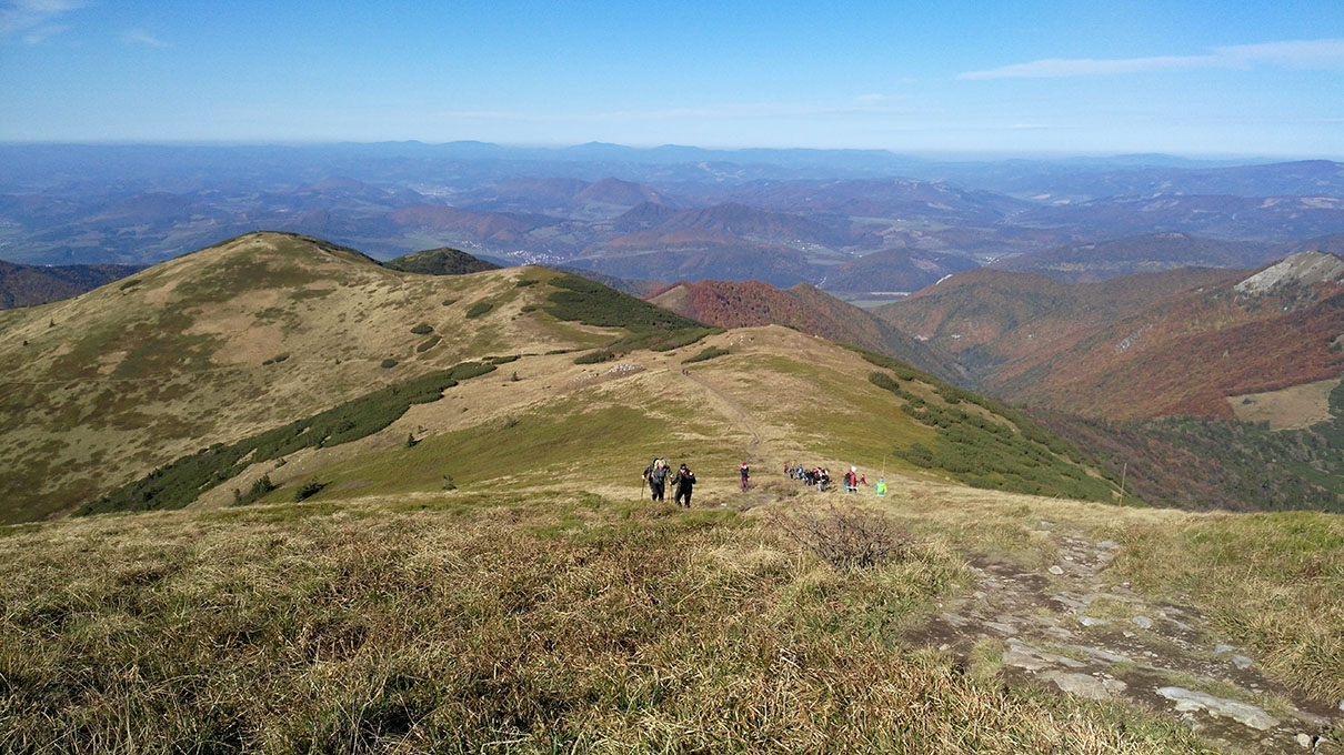
Around Hollókő: for hikers who want more than summits
Lower hills, but long, rolling routes.
The Cserhát has many wooded ridges, meadows, small villages and historic castle sites. This is not a land of towering rock walls: what makes a hike memorable here is the rhythm of the landscape, the viewpoints, the traditional villages and the cultural heritage.
The Hollókő area, Szanda Castle, the Tepke area and forested ridges in Nógrád County.
A relaxed day out with village stops, or a longer section of Hungary’s National Blue Trail.
Routes often climb and descend repeatedly; even lower hills can add up to a substantial amount of ascent.
Hollókő’s World Heritage-listed old village and castle are well worth visiting in their own right. For a nature-focused outing, go beyond the village: the surrounding forest trails reveal the true scale of the Cserhát.
Zemplén Mountains – castles, mountain villages and volcanic ridges
Around Regéc and Füzér, historic sites combine naturally with forest hikes
Because it lies farther from central Hungary, this region is particularly rewarding for a multi-day visit.
The Zemplén Mountains are a varied volcanic region in northeastern Hungary. The Nagy-Milic (895 m) is one of its prominent summits, but many visitors come for castle-topped hills and secluded forest paths. Regéc, Füzér, Telkibánya and Háromhuta make particularly good bases.
Regéc Castle, Füzér Castle, Nagy-Milic, Füzér’s castle hill, forest nature trails and longer ridge walks.
Wooded volcanic hillsides, occasionally rocky; some castle-hill paths are short but steep.
Plan accommodation and trailheads together; public transport between more remote villages is not always frequent.
The photograph shows Regéc Castle, not a generic mountain scene: it is one of the Zemplén Mountains’ landmark historic sites, standing on a hilltop. This region is ideal if you want to combine hiking, a viewpoint and a castle in one day.
Aggtelek Karst – caves and surface karst formations
The plateau deserves a walk of its own alongside the Baradla Cave
The main attraction is not summit height but the shaping power of rock and water.
The Aggtelek Karst is an extraordinary limestone region close to Hungary’s northern border. Beyond the famous Baradla–Domica cave system, its surface karst features, sinkholes and grass-covered plateaus are also fascinating. Some of the area’s caves form part of a UNESCO World Heritage Site.
Nature trails, karst meadows and viewpoints around Aggtelek and Jósvafő.
Baradla Cave: guided visits of different lengths depending on the tour selected.
A cave visit is not a freely accessible hiking trail. Check current tickets and visiting arrangements with the operator.
If you have just one weekend, combine a guided cave tour with a shorter walk on the surface. That way, you’ll experience not only the stalactites and stalagmites but also the landscape that created the underground formations.
Pilis and Visegrád Mountains – two neighboring but different ranges
Limestone crags on one side, volcanic mountains on the other
Within a short drive around the Danube Bend, you can explore very different types of hiking terrain.
The Pilis consists mainly of limestone and dolomite, with exposed rock, caves and steep-sided valleys. The Visegrád Mountains, by contrast, are volcanic. They include Dobogókő and the area around Prédikálószék, overlooking the Danube Bend. The names are not interchangeable, even if they are sometimes grouped together in everyday speech.
Shorter marked walks and viewpoints around Dobogókő.
The Prédikálószék and Vadálló-kövek area, where some sections can be steep and rocky.
Rám Gorge (Rám-szakadék): plan carefully in wet weather and check closures and one-way route rules.
Seen from above, the Danube Bend makes the area’s popularity easy to understand: the river’s curve, steep wooded slopes and villages form a spectacular panorama. However, popularity does not mean every trail is suitable for beginners.
Buda Hills – genuine mountain hiking beside the capital
Normafa, János-hegy and the surrounding forests: plenty of choices with little travel
Don’t be fooled by the proximity to the city: some rocky paths still require care.
The Buda Hills offer a dense network of marked trails, easy-to-reach trailheads and varied limestone and dolomite terrain. János-hegy, the Normafa area, Nagy-Hárs-hegy and Nagy-Kopasz are excellent for regular shorter hikes.
A walk around Normafa followed by an easy forest loop on marked trails.
Elizabeth Lookout Tower on János-hegy and Kaán Károly Lookout Tower on Nagy-Hárs-hegy.
Nagy-Kopasz or a longer ridge hike in the Buda Hills with repeated climbs.
Many routes are accessible by public transport, and switching to a shorter alternative is relatively easy when the weather turns. In busy areas, follow the different rules for cycling and walking routes.
Bakony – gorges, beech forests and stream valleys
Cuha Valley offers something special even if you’re not looking for summits
Beyond its forested valleys, the ridges of the High Bakony also provide a challenge.
The Bakony is an extensive range within the Transdanubian Mountains. The streamside path through Cuha Valley, its rocky passages and railway viaducts give a hike a distinctive atmosphere. Kőris-hegy (709 m) is the Bakony’s highest point, but one summit alone cannot capture the range’s beauty.
Cuha Gorge, Porva-Csesznek, Vinye, and Kőris-hegy and its surroundings.
A shaded summer hike, a spring stream-valley walk or an easier full day in the forest.
Rocks and crossings can be slippery after rain, and the stream’s water level can change.
The Bakony rewards two approaches: spend one day on a valley-and-gorge routeand another on a ridge walk with viewpoints. Do not assume wet winter conditions are as easy as dry summer weather.
Balaton Uplands – volcanic hills, panoramas and geological formations
Badacsony and the Káli Basin: combine a hike with a remarkable landscape
Even a modest climb can reward you with huge views.
The Balaton Uplands are known above all for their volcanic remnant hills: Badacsony, Szent György-hegy, Csobánc and the surrounding basalt formations. Each hill gives a different perspective on Lake Balaton and the neighboring countryside. The fossil geyser cones of Tihany and the stone fields of the Káli Basin add further geological interest.
Lookouts on the slopes of Badacsony or the area around the castle ruins on Csobánc.
The Aranyház geyser cone at Tihany, basalt columns on Szent György-hegy and the stone fields of the Káli Basin.
Exposed south-facing slopes can be very sunny in hot weather. Carry enough water and plan breaks in the shade.
Here, hiking and understanding the landscape go hand in hand: from one hilltop you can see several remnant hills of very different shapes, rising above the surrounding terrain and preserving traces of the region’s volcanic past.
Vértes and Gerecse – castle ruins, plateaus and hidden valleys
Even Transdanubia’s lower mountains have distinctive trails
These neighboring ranges offer surprisingly different mountain experiences.
The Vértes is a forested range made mainly of carbonate rocks, with dramatic cliffs and castles along its edges. Csókakő Castle is among its most distinctive sights. Nearby, Gerecse offers plateaus, dolomite and limestone slopes, a network of forest trails and views towards the Danube.
Csókakő Castle, Gánt and forest routes through the Vértes.
The Gerecse-tető area, forests near Baj and Tata, and traces of historic quarrying.
Hikers seeking medium-length, varied forest walks, or those interested in combining nature and history.
Choose the Vértes for a castle on a rocky outcrop; for longer, quieter forest walks, the Gerecse may suit you better. The two ranges are distinct geographical units, so this guide does not treat them as a single mountain range.
Mecsek and Villány Mountains – southern scenery and unusual rock formations
Zengő, Jakab-hegy and the extraordinary Babás-szerkövek rocks
Steep forest trails near Pécs alternate with open views in the southern hills.
The Mecsek is one of southern Hungary’s most distinctive mountain regions. Zengő (682 m) is its highest point. Around Jakab-hegy, the unusual rocks of Babás-szerkövek and Zsongor-kő give hikes their distinctive character. The forests above Pécs are easily accessible, while more remote trails may be quieter.
Zengő, Jakab-hegy, Babás-szerkövek, Zsongor-kő and the forest trails near Pécs.
The Szársomlyó area has exceptional geological and conservation value; current visitor restrictions apply in its protected zones.
Spring and autumn can be particularly pleasant. Exposed southern slopes may be very hot in summer.
The photograph shows the Babás-szerkövek, real, recognizable rock formations on Jakab-hegy in the Mecsek. Places like this distinguish the Mecsek from northern Hungary’s higher, more densely forested ranges.
Kőszeg and Sopron Mountains – the forested face of the Alpine Foothills
Around Írott-kő, the proximity of the Alps is already apparent
On Hungary’s western edge, the climate and forests have a different character.
The Alpine Foothills (Alpokalja) are best known for the Kőszeg Mountains and the Sopron Mountains. In the Kőszeg Mountains, Írott-kő is Transdanubia’s highest point, near the Hungarian–Austrian border. The region has a cooler, wetter climate and many shaded woodland trails.
Írott-kő, Hétforrás, Óház Lookout Tower and woodland walks near Kőszeg.
Károly Lookout Tower, Várhely Lookout Tower and forest nature trails near Sopron.
Some trails run close to or cross the national border; check current trail markings and regulations.
If you’re looking for a cool, wooded hike during summer heat, these western Hungarian mountains make a good alternative. In autumn and winter, however, fog and wet leaves can be more frequent hazards.
Which Hungarian mountain range is right for you?
There’s more to the choice than kilometres
The best route fits your current fitness, the season and your interests.The following comparison is a hiking-planning guide, not an objective ranking. The same range can offer both a two-hour stroll and a steep, strenuous full-day hike.
| What are you looking for? | Recommended region | Why? |
|---|---|---|
| Hungary’s highest summit | Mátra | Kékes and the higher mountain ridges. |
| Plateaus and rocky escarpments | Bükk | Tar-kő, karst formations and deep valleys. |
| Wild forests and stream valleys | Börzsöny | Large forest blocks, valleys and considerable elevation gain. |
| Castles and remote mountains | Zemplén | The areas around Regéc and Füzér. |
| Panoramas near Budapest | Buda Hills and Danube Bend | Short travel times, numerous trails and viewpoints. |
| Gorges and cool forests | Bakony | Cuha Valley and beech forests. |
| Views of Balaton and volcanic landforms | Balaton Uplands | Badacsony, remnant hills and Tihany. |
| Rock formations and southern scenery | Mecsek | Jakab-hegy and Babás-szerkövek. |
| Cooler western forests | Alpine Foothills | Kőszeg and Sopron Mountains. |
Don’t choose a hike merely based on the elevation of a range’s highest summit. Instead, consider your chosen route’s total ascent, distance, trail conditions, exposed sections and current weather.
When is the best time to hike in each mountain range?
The same place looks and feels very different across the seasons
Weather, sunset time, ground conditions and drinking-water availability all need to be considered.In spring, stream valleys are spectacular but may be wet from melting snow and rainfall. In summer, the shaded forests of the Bakony, Bükk and Alpine Foothills are appealing, but exposed hills near Balaton can be exhausting in extreme heat. In autumn, the colours of the Börzsöny, Zemplén and Mátra forests can be beautiful. Shorter days and slippery leaves call for an earlier start. In winter, the higher Mátra and Bükk may have snow, ice, wind and fog.
Check distance, total ascent, trail markings and GPX, as well as whether the route is circular or point-to-point.
Compare conditions at higher and lower elevations, including expected rainfall and wind gusts.
National parks and other protected sites may have additional rules or seasonal restrictions.
Parking, buses and return train journeys are part of the plan, especially on point-to-point hikes.
Some protected geological sites, caves and nature reserves can only be visited with permission or a guide. Before setting out, check the latest visitor information from the relevant national park or forestry operator.
Frequently asked questions about Hungary’s mountains
Geographical names, mountain heights and hiking difficulty are not the same thing
Straightforward answers to the most common misconceptions.Which is Hungary’s highest mountain range?
The Mátra, home to Kékes, Hungary’s highest point at 1,014 metres.
What is the highest summit in the Bükk?
According to modern topographic surveys, Szilvási-kő is the highest at about 961 metres. Older sources may name Istállós-kő instead.
Are the Pilis and Visegrád Mountains the same range?
No. They are immediate neighbors but geologically different: the Pilis is predominantly limestone and dolomite, while the Visegrád Mountains are volcanic.
Where can I find the most scenic hills near Lake Balaton?
Badacsony, Szent György-hegy, Csobánc and the Káli Basin are among the best-known hiking areas in the Balaton Uplands.
Which mountain ranges are good for beginners?
The Buda Hills, Cserhát, some valley trails in the Bakony and shorter walks in the Balaton Uplands can be good choices. The specific trail’s elevation gain and surface matter more than the name of the mountain range.
Where will I find the wildest scenery?
The dense Börzsöny forests, deep Bükk valleys and remote wooded trails in Zemplén are good candidates. A sense of wilderness is subjective, so there is no objective ranking.
Is distance alone enough to plan a hike?
No. Total ascent, descent, rocky or muddy stretches, exposed sections and weather can be just as important.
Can you hike in Hungary’s mountains in winter?
Yes, but snow, ice, cold and early darkness can make the same terrain require different routes and equipment. Check current trail closures and forecasts.
Hungary’s mountains cannot simply be ranked from most to least beautiful. Tar-kő, Csóványos, the castle hill at Regéc and Badacsony all offer something different; the best hike is where the scenery you’re looking for meets a route you can comfortably manage.
Hungary’s mountain ranges: not one checklist, but a world of hiking experiences
Mátra, Bükk and Börzsöny
Steeper ridges, greater daily ascent and more complex routes — with options at different difficulty levels.
Bakony, Balaton Uplands, Aggtelek and Mecsek
Gorges, volcanic remnant hills, caves and unusual rock formations: geology becomes the star of the hike.
Choose a route that suits you, not just a mountain range
Check the ascent, terrain, access and expected conditions. That way, the same Hungarian landscape can offer new discoveries to both beginners and experienced hikers.

Sources, photographs and licensing
This article draws on professional, official and trail-related sources for its geographical descriptions, conservation information and hiking suggestions. Travel times and ascent figures apply only to the specific recommended Túraprogramok routes.
- Hungarian National Parks – conservation and visitor information
- Hungarian Hiking Association (MTSZ) – trails, waymarking and the National Blue Trail
- Aggtelek National Park Directorate – Baradla Cave and karst region
- Bükk National Park Directorate – Bükk Mountains and visitor attractions
- Duna–Ipoly National Park Directorate – Börzsöny, Danube Bend and Pilis
- Balaton Uplands National Park Directorate – volcanic remnant hills
- Duna–Dráva National Park Directorate – nature conservation around the Mecsek
- Túraprogramok – hiking routes in Hungary
Location-specific photographs: Wikimedia Commons. Each photograph’s source page credits the original creator and specifies its free license or public-domain status. Individual source links appear beneath the relevant images. The 16:9 display crops the original image on screen; the original file is not altered.
- It writer / Wikimedia Commons – Panoramic view from the top of Csobánc.jpg (CC BY-SA 3.0)
- Szilas / Wikimedia Commons – Grand Hotel Galya, view towards the Kékestető.jpg (CC0)
- Wikimedia Commons / Panoramio / Wikimedia Commons – Tar-kő panoráma – panoramio.jpg (Commons file page)
- Aspectomat / Wikimedia Commons – Csóványos.JPG (public domain)
- Takkk / Wikimedia Commons – Cserhát Mountains, north of Hollókő.JPG (CC BY-SA)
- Palickap / Wikimedia Commons – Regéc, vár (1).jpg (CC BY-SA 4.0)
- Wikimedia Commons / Wikimedia Commons – Baradla-barlang aggteleki főbejárat.jpg (Commons file page)
- Wikimedia Commons / Wikimedia Commons – Dunakanyar panorámakép.jpg (Commons file page)
- Gergely Dóra Viktória / Wikimedia Commons – Erzsébet-kilátó a János-hegy tetején.jpg (CC BY-SA)
- Christo / Wikimedia Commons – Cuha-völgy, 32.jpg (CC0)
- Wikimedia Commons / Wikimedia Commons – Badacsony a Kápolna dombról nézve, 2018 Balatonboglár.jpg (Commons file page)
- Wikimedia Commons / Wikimedia Commons – Csókakő, Hochebene Vértes, 2023 Bodajk.jpg (Commons file page)
- Buzasger / Wikimedia Commons – Babás szerkövek.jpg (Commons file page)
- Vasi Manó / Wikimedia Commons – WRITTEN-STONE PEAK AT KŐSZEG (Irottkő-Geschriebenstein) – panoramio (1).jpg (CC BY-SA 3.0)
Licensing note: Images published under Creative Commons licenses may require attribution and compliance with specific license conditions. Additional requirements may apply to the reuse or adaptation of some photographs. Captions link to the original file pages.
Hiking route recommendations: The three cards use markup compatible with the existing TN Cikkmotor v5.9 topic-based recommendations. Túraprogramok is the source of current detailed route information.